

Great Lakes Shoreline Tour: Lake Superior’s UP Coastline

There’s a reason it’s called Superior.
There is no other lake like it in the world. It is truly immense, so big that it contains more water that all four of the other Great Lakes combined. You’d need two more Lake Eries to equal the water in Superior.
Superior is so big we will need two reports to cover it all for our Verizon Great Lakes Roadtreking Tour.
In the video above, we head out from Saulte Ste Marie, Mich., where Superior flows into the St Mary’s River and, eventually all of the other lakes, following the big lake west. We did our best to take highways and roads that would keep us as close to the shore as possible.
Superior is so huge that to cover it, we would travel across three states and two time zones. We decided to make this first segment all Michigan, where Superior’s shore forms the northern boundary of the Upper Peninsula.
At the Pointe Iroquois Lighthouse near the Michigan UP town of Bay Mills, Ron Gilmore – who everyone knows as “Gilly,” joked with us about life on the Superior’s Michigan coastline.
“Up here, we have two seasons. One is shoveling and the other is swatting,” he says of the long winter and the UP’s notorious biting insects. “We have eight months of winter and four months of bad sledding.”
Exaggeration. Yeah. We found that the usual spring bug invasion had died down, thanks to breezy, comfortably cool weather. We had our Roadtrek Etrek RV heater on for several nights.
Further west and then south for a dozen miles past the town of Paradise, is Tahquamenon Falls, the largest waterfall east of the Mississippi. We had spotty phone service here and in several other areas of the UP. But I hooked up my Wilson Sleek cell phone booster and went from zero bars to three bars.
In Munising we spent two days touring the pictured Rocks National Lakeshore, a 42-mile stretch of sandstone cliffs carved out by the mighty waves of the big lake. The best way to see it is on a boat, like the ones operated by the Pictured Rocks Cruise Line. It’s a three hour trip and gets you close enough to the formations to almost touch them.
Another way to tour them is by kayak, though the chilly 44-degree water temperature kept me boat bound. Locals said the lake, always cold, is much colder than usual this year because of the severe winter. There were icebergs out in the lake until mid-June.
These cliffs are up to 200 feet above lake level. They have been naturally sculptured into shallow caves, arches, formations that castles, battleships, event faces. Roads lead you to several overlooks, if you’d rather stay on land.
Munising may be surrounded by wilderness, but it is a very connected town. Entrepreneur Tom Dolaskie IV runs a number of very high tech companies right on the main highway. His IT clients include hotels all over the world.
He could live anywhere he wanted. But he lives on the Superior shore because of the beauty and the opportunity it gives him do photography and video.
You can see his videos and photos at youtube.com/roamwherever
Like me, he flies a personal drone and when I stopped by to visit, he and his team dropped everything for a chance to go outside and fly.
We stayed at the Munising Tourist Park Campground, just a couple miles out of town on US-28. We were camped right on the lake and treated to gorgeous sunsets.
All along Highway 28 west of Munising are roadside parking areas that provide great beach access. We walked empty beaches that we had all to ourselves. Tai gulped the fresh, cool superior water and romped in the sand. We think Tai likes sand so much because it feels like snow. He loves those beach walks and we’ve been able to find places on all the Great Lakes so far where he can play in the surf.
We moved past the harbor town of Marquette. Up the Keewenaw Peninsula is Copper Harbor, the northernmost part of Michigan where the Superior shore is rugged and rough and stunningly beautiful.
And then, there’s the far western end of the UP and the 60,000-acre Porcupine Mountains, one of the few remaining large wilderness areas in the Midwest, with towering virgin timber, secluded lakes, and miles of wild rivers and streams. Our favorite camping spot is the rustic Presque Isle campground at the western end. There’s no electricity, no water, no generators. We didn’t need any of it with our Etrek and we really like the wilderness quiet there.
If you must have hookups, the Union Bay Campground at the eastern end of the park has them.
In our next segment, we’ll follow Superior into Wisconsin and Minnesota.
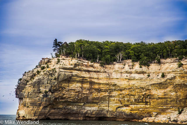
Pictured Rocks National Lakeshore
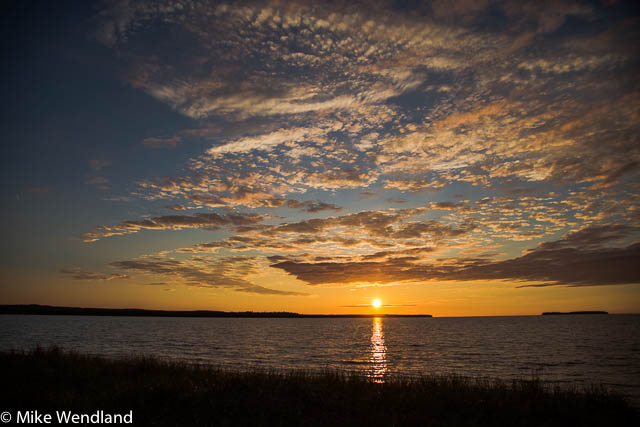
Sunset over Lake Superior, near Munising
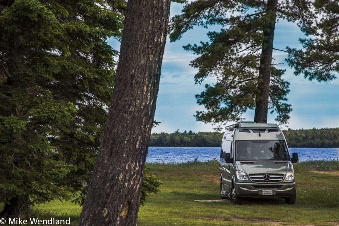
Our spot at the Munising Tourist Park Campground
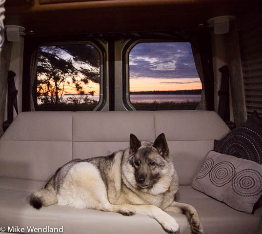
Tai, chilling inside as the sun sets.
0 Comments
Recommended Comments
There are no comments to display.
Please sign in to comment
You will be able to leave a comment after signing in
Sign In Now