Our Favorite Places - In Love With Deserts - Part 2
Immediately after leaving Joshua Tree National Park we turned north to Death Valley. Our base of operations was just inside the Nevada state line at the Longstreet Casino in the Amargosa Valley. We arrived and parked at our very nice campsite, which was flooded in just an hour or so as the sprinklers came on at the golf course. We moved to a different site.
It turned out that the Casino was celebrating their seventh anniversary and we would enjoy their celebration. They had scheduled David John and the Comstock Cowboys, a western singing group that we had seen several years earlier at a convention in Reno. We were there for each of their performances through the weekend. We even got the lowdown on the singing group from the parents of one of the band members who was sitting at the same table with us. We added to our collection of their albums and still enjoy the great campfire songs they sing.
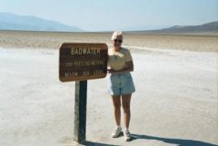
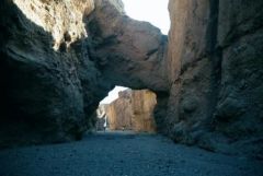
From the Amargosa Valley we traveled through Death Valley Junction into the park. Once we turned toward the park, we could coast most of the way to Furnace Creek and the park headquarters. On our first trip into the park we drove south from the headquarters to Badwater, which is near the lowest point in the park, more than 260 feet below sea level. Along the way we stopped to see the Artists Palette, the Natural Bridge and the Devils Golf Course.
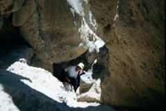
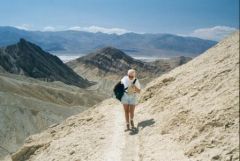
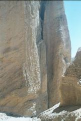
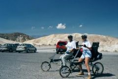
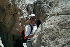
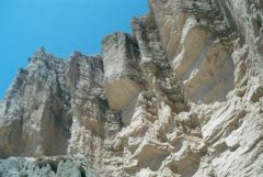
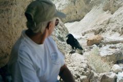
The following day we contrived a bicycle ride from Zabriske Point, coasting down to Badwater Road to Golden Canyon. It turned out the wind blowing through the valley was strong enough that Louise had to walk her bike the last quarter mile. We locked up the bicycles at the Golden Canyon parking lot and then hiked back to Zariske Point, where we had left the car. On the hike we took a side trail to see the Cathedral formation and had lunch on the way back from that side trip. Sitting in the shelter of an overhanging rock in the narrow stream, we were joined by a Raven that waited just a few feet away from us as we ate.
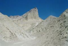
We continued on over Manly Beacon and then to Zabriske Point. We lost a hat along the way when Louise bent over to tie a shoe. I started to go after it, but after we watched it cross the second line of hills, I decided it wasn't worth it. Death Valley is a desert virtually without plants. It is just bare naked rocks! As a retired earth science teacher, I found the exposed rocks and the erosional features laid bare to be quite amazing and in their own way beautiful. It is obvious that there are periodic heavy rains within the park as the evidence of water erosion is everywhere. In fact I remarked to Louise that I would rename the park, "Erosion National Park." Once we arrived at Zabriske Point we retrieved the bicycles and returned to camp.
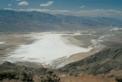
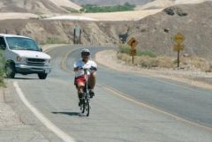
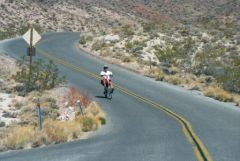
The next day we drove to Dantes View, which overlooks Badwater from 5,600 feet above and just two miles from the lowest point in Death Valley. The view was spectacular and I formulated the plan for the next bike ride. The next day, Louise drove me to Dante's view. I unloaded my Bike-E and coasted from there to Furnace Creek, a distance of 23 miles. I had to pedal just a few times, but most of the time I was just enjoying the ride. Coming off the alluvial fan at Dante's View, Louise clocked me at 35 miles per hour -- coasting! What a ride!
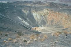
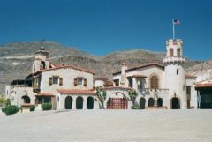
We moved to the Stovepipe Wells Campground after several weeks. This was the only campground in the park with hookups and it only had 30-amps and water. We stayed for just four days as the temperature was now hitting 100 degrees every day. From Stovepipe Wells we explored the northern end of Death Valley, including Scotty's Castle, the area around Ubehebe Crater and Emigrant Canyon. We also saw the Desert Pupfish in Salt Creek.
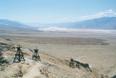
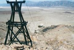
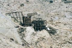
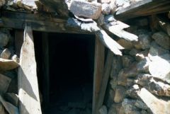
Our favorite adventure in this part of Death Valley was a hike to the Keane Wonder Mine. The trail to this abandoned gold mine features the remains of a tramway used to bring the ore down the mountainside, several entrances to the mine and the main shaft opening and processing center at the top of the tramway. The trail is a torturous 1,300-foot climb in about a mile of trail. We had lunch at the mine site and enjoyed a spectacular view across the valley before descending. At the base of the mountain is the mill, which we explored after the hike.
Our egress from Death Valley provided another thrill. Departing from Stovepipe Wells to the west on California Highway 190 provides some heart stopping driving for RVs as the road is narrow with no shoulder and steep drops. Louise had a spectacular view out the passenger window when she could open her eyes. I bought a paperback book, Death Valley '49, written by William L. Manly, one of the guides who led a pioneer group into Death Valley. After finding a way out, Manly returned to save the pioneers who had been left in Death Valley. No one died in Death Valley, but the wagons were abandoned and most of the oxen eaten while in the valley and on the way out. The tale was a riveting description of the hardships endured by these '49ers as they traveled west to a better life.
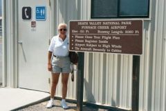
Our final encounter with Death Valley on this trip originated from Visalia, CA. I got checked out in a Piper Arrow at the Visalia airport. From there we flew over the Sierra Nevada to Death Valley making a landing in the park at the Furnace Creek airport. This airport is the lowest airport in the US being almost 200 feet below sea level. We had lunch and then took off for the return flight. We circled over the Keane Wonder mine and flew east to the Amargosa Valley and our campsite at the Longstreet Casino. Then we crossed Death Valley again headed westward over Scotty's Castle and Ubehebe Crater. Continuing on east, we crossed over Yosemite National Park, we saw frozen lakes and Half Dome from the air. We landed in Columbia, CA had dinner and then flew back south through the central valley of California at night.


1 Comment
Recommended Comments
Please sign in to comment
You will be able to leave a comment after signing in
Sign In Now