Search the Community
Showing results for tags 'washington'.
Found 13 results
-
We are going to Beaver Lake Campground in Custer SD tomorrow for 5 days after being in Sioux Falls getting our mailing address and licenses. After that we want to go down the Pacific Coast Highway before staying in Casa Grande, Arizona beginning October 1st. Any suggestions as for how far north we should go in Washington or Oregon to start south on the Pacific coast highway? Rick and Sharon
-
From the album: Vista
The Whale all set up at the Little Creek Casino Resort in Shelton, WA for another Sonic Funk gig weekend!-
- Winnebago Vista
- Shelton
-
(and 2 more)
Tagged with:
-
From the album: Vista
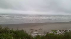
A shot of the Pacific from Hwy 101 in Olympic National Park, WA.-
- Winnebago Vista
- Washington
-
(and 4 more)
Tagged with:
-
From the album: Vista
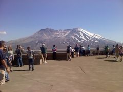
A shot of Mt. St. Helens from the Johnston Ridge Observatory, WA.-
- Cascade Mountains
- Dantes Peak
- (and 4 more)
-
From the album: Vista
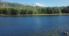
A shot of Mt. St. Helens, WA.-
- Cascade Mountains
- Dantes Peak
- (and 4 more)
-
From the album: Vista
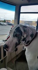
Lola waiting with me for the Clan at a Walmart in Aberdeen, WA.-
- Washington
- Walmart
-
(and 3 more)
Tagged with:
-
From the album: Vista
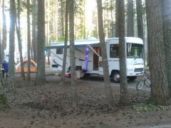
Another shot of the Whale at Lake Easton State Park, WA.-
- Winnebago Vista
- Washington State Parks
-
(and 2 more)
Tagged with:
-
From the album: Vista
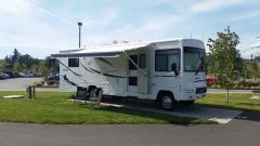
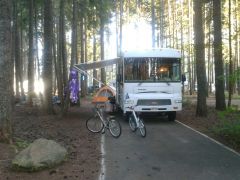
A shot of the Whale set up at Lake Easton State Park, WA.-
- Winnebago Vista
- Washington State Parks
-
(and 2 more)
Tagged with:
-
From the album: Vista
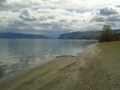
A view of the Columbia River Gorge looking south at Wanapum State Park, WA.-
- Wanapum State Park
- Washington State Parks
- (and 3 more)
-

The Quinault Valley - Land of Giants
tbutler posted a blog entry in Tom and Louise on Tour in North America
The Quinault Valley of the Olympic Peninsula was our last stop visiting the peninsula. Arriving at the Rain Forest Village Resort RV Park, we located an open site. We arrived on the Thursday before Labor Day weekend so we were glad to get a site at this first come, first served RV Park. They do not take reservations. The park is more like a state park campground than the usual commercial RV Park. Upon arrival we were given several brochures detailing local attractions, most of these were related to the trails and trees in the area. On the south side of Lake Quinault where we were there is a web of trails through the forest. Most of the trails are in the Olympic National Forest. Trails are well maintained and marked. Some of the trails have interpretive signs to explain what you are seeing. We hiked many of the shorter trails near the resort during this visit. One of the surprises for us was the amazing abundance of champion trees in this valley. Champion trees are trees which have been identified by the Forestry Association as the largest tree of a species. For each species a single tree somewhere is designated as the champion tree. In our campground the champion Sitka Spruce was located just east of our campsite. Of all the Sitka spruce trees in the world, this one has been identified as the largest. The criteria involves a formula, Trunk Circumference (inches) + Height (feet) + ¼ Average Crown Spread (feet) = Total Points, which is used to assess the relative status of a tree. The champion Sitka spruce tree is 55.7 feet in circumference and 191 feet tall and is estimated to be over 1000 years old. Across Lake Quinault on the northern side of the lake stands the champion western red cedar. This tree is a grizzled old tree. It stands 174 feet tall and is 63.5 feet in circumference with a diameter of 19.5 feet. The center of the tree has decayed away leaving it open like a chimney. The top of the tree has been broken off, perhaps more than one time. You can stand in the center of the tree and look up through the trunk to see the sky. Given all this, the tree still has numerous live branches. Getting to this tree is a short 1/2 mile trail up steps and across boardwalks. Standing at the base of this majestic old tree trying to imagine what it has been through and how it survived is a experience in humility. This tree is the largest tree in the state of Washington and other than the redwoods and Sequoias in California this tree is the largest tree in the world. It is really amazing to find two champion trees of such large size located together. The rest of the story is that there are four more champion trees in the Quinault Valley. Not far from these two giants stands the largest Douglas fir tree in the world. It is located in Quinault Research Natural area and is not accessible to the public. This tree stands 302 feet tall, has a circumference of 40 feet 10 inches and is 13 feet in diameter. Further up the valley stands the largest yellow cedar tree in the United States. Seven miles up the skyline trail you will find this tree standing 129 feet tall, 37 feet 7 inches in circumference and 11.96 feet in diameter. The largest western hemlock in the United States is 14 miles up the Enchanted Valley trail. Its height is 172 feet, circumference is 27 feet 11 inches and its diameter is 8.89 feet. Finally, the champion mountain hemlock is 13 miles up the Enchanted Valley trail. At 152 feet tall and over 6 feet in diameter it is the largest mountain hemlock in the world. We didn't visit the last four trees but were able to see two very spectacular trees with just a short walk. The trails here are interesting and scenic. If you would like to know more about champion trees check out this web site. There are champion trees all over the US and world. You might be surprised to learn there is one near you. I know that in the Rio Grande Valley of Texas where we winter there are several champion trees. I drive past one of them on my way to the bowling alley where we bowl each Friday during the winter.-
- Olympic Peninsula
- Washington
-
(and 3 more)
Tagged with:
-

Encounters with Native American Cultures
tbutler posted a blog entry in Tom and Louise on Tour in North America
Seattle, the largest city in Washington, is named for an Indian chief. Many other features in this area have Native American names. On our travels, we visited several museums and cultural centers that helped to build our understanding of and respect for the culture. Our first museum was in Coulee Dam on the Colville Indian Reservation, in north-central Washington. The Colville Confederated Tribes Museum has a good historical record of the tribes with many old pictures, examples of clothing and accounts of the lives of their ancestors. Like all of the Indians in this part of the country, salmon played a key role in the lives of the Colville. Also like other tribes, its whole world changed when it began interacting with societies from other parts of the world. The Colville Indians lost their salmon when the Grand Coulee Dam was built in the 1930s. For the Colville, salmon were not just food; salmon also played a role in their stories and legends, which were the basis of their culture. Below Grand Coulee Dam is the Chief Joseph Dam, which is on the border of the Colville Indian Reservation. Chief Joseph was from the Nez Perce Tribe. He was a peacful man, making agreements with the U.S. Government to move his tribe to a reservation. When gold was discovered on the reservation, the government wanted to move Chief Joseph to a small part of the original reservation. Young Nez Perce warriors resisted and raided white settlements. This set off a chain of events that had the U.S. Cavalry pursuing the 700-member band for an extended time before Joseph's surrender. Chief Joseph surrendered expecting to be able to seek out members of the tribe, which had been lost in the extended fighting. Instead, he and the rest of his tribe were taken to Kansas and then Oklahoma, where they stayed until 1885. Many members of the tribe died in Oklahoma before they were allowed to return to the Pacific Northwest. They never were allowed to return to their homelands, ending up on what is now the Colville Reservation. Further down the Columbia River, the Wanapum and Chief Joseph Dams were built on the lands of the Wanapum Indian Tribe. Wanapum Dam visitors center hosts a Wanapum Heritage Center with a record of the history and culture of the Wanapum Indians. The Wanapum were moved from their homes so the Priest Rapids Dam could be built. Their historic homelands and homes were flooded by the lake backed up behind Priest Rapids Dam. One of the things said by Rex Buck Jr. at the dedication of Priest Rapids Dam, still haunts me. Rex Buck Jr. was awarded the Peace and Friendship Award by the Washington State Historical Society for his efforts to advance the cultural diversity of Washington State. He said to the crowd that day, "What we do to the Earth, the Earth will do to us." The Wanapum continue to follow some tribal traditions today, gathering roots and berries and fishing for salmon as permitted by Washington State law. They also operate an outreach program for schools and the community to bring them information about their culture. A while later we ventured onto the Olympic Peninsula. Louise wanted to start in Hoodsport and see the eastern side of the peninsula. After about three days touring, we learned of a celebration that would happen during the weekend. A gathering of the Pacific coastal tribes would begin with the Paddle to Squaxin. Traveling in their ceremonial and war canoes, the coastal tribes would come to Squaxin Island in the Olympic Peninsula. The Squaxiin tribe would host a meeting and potlatch on their home grounds. The canoes would arrive in the port at Olympia, Washington and the public was invited. We arrived shortly before noon and rode the shuttle to the port. A crowd of hundreds were there to welcome the canoes as they came into port. In the stands reserved for tribal members were drummers, chanting to welcome the arriving canoes. One by one and in groups of a dozen or more, canoes with three to 30 tribal members paddled their canoes into the port. Some wore ceremonial masks, others wore T-shirts. Most had painted ceremonial canoes and the native form of pointed paddles. Rowing in unison and periodically raising their paddles vertical above their heads in salute, they passed the crowd and then lined up along a roped area for their formal approach and request to land. I took many pictures of the first canoes, then learned that 94 canoes were expected. Even with my digital camera I had to re-evaluate the number of pictures I was taking. Besides my main 4GB card, I had an additional three 1GB cards. All but a few MBs remained at the end of the day. The procession of canoes was a spectacle to behold. Canoes from up the Canadian coast -- and another canoe was even flying an Alaskan flag -- came into port that day. We talked with some of the participants on the shuttle back to the parking lot. We let them know that how moved we were by the cultural display and that we appreciated being able to observe this pageant. We continued to the northern Olympic Peninsula. While visiting friends on Vancouver Island we visited an art gallery in Tofino. Later in an art shop in Duncan, we found several native art pieces, which we purchased for gifts. We also picked out a wall hanging for our home in Texas. Returning to the Olympic Peninsula, we continued to learn more about the tribes of the northern peninsula. Moving to the community of Forks on the northwestern side of Olympic National Park, we visited several tribal communities. The Makah reservation is located at Neah Bay and includes Cape Flattery, the northwestern tip of the Olympic Peninsula. To the south their original village, Ozette, was buried by mud flows. The tribe relocated to Neah Bay. Years later, beach erosion during a storm exposed the village in Ozette. Excavations of Ozette village has yielded many artifacts from pre-contact days. Those items, which provide a record of the civilization that existed before Europeans arrived around 1790, are housed in the Makah Cultural and Research Center in Neah Bay. Another native village is atLa Push on the Pacific shore west of Forks. In 1889, their homes were burned by a settler seeking to claim their territory for his own. All of their ancient masks and cultural records were lost in the fire. Today the Quileute tribe has a resort and RV park on the coast. With beaches of Olympic National Park to their north and south, the Quileute tribe has the land around the mouth of the Quillayute River. The Quileute tribe was the most welcoming of all the tribes we encountered. Each Wednesday night, the tribe has a drum circle and potlatch and the public is invited. Louise and I joined them one night. We were invited into the circle and were welcomed repeatedly. We watched, listened and were invited to join in their drum circle. The men with sacred wolf masks danced in the center of the circle as the ladies danced around the perimeter. The ceremony was very stylized, and by observing, we could detect behaviors of dancers that were part of the ritual dances. We left that evening feeling like we had a real connection with the Quileute people and their culture. Several days later we returned to find David Wilson, carving teacher at the Quileute school. Visiting with David and his wife, Anna, we saw some of his works of art. He has carved 20-foot-high totems and ceremonial staffs, canoe paddles and many other fine works of art. We discussed a small totem with him and came up with a design. He is currently working on carving that totem for us. Throughout our visit to the northwestern United States, we have encountered the Native American culture and have learned much from and about them. Uniformly they have welcomed us, sometimes personally, at other times through their celebrations, museums and cultural centers. Here are a people who have endured many injustices and have had their culture strongly altered in a relatively short period of time. Despite the forces that have thrust them into the modern era, they continue to be friendly and open to the outside world. Perhaps they remain too innocent in their approach to the outside world. I believe they are representing their culture to the rest of the world in the best possible way. To observe their customs and culture, one can not help but come away with admiration and respect for them and their struggle to cope with the changes thrust upon them. Since our travels into Canada years ago, Louise and I have used the term First Nations as a better descriptor for those who were here before the rest of us. After all, 350 million of us have moved in on their territory and proceeded to tell them where to live, how to live, what language to speak and what to believe. We owe them a great deal of respect. Perhaps we can even support them in their efforts to recover their native languages, customs and culture.- 2 comments
-
- Makah
- Native Americans
- (and 8 more)
-

Signs of Recovery on the Road
tbutler posted a blog entry in Tom and Louise on Tour in North America
We have traveled 6500 miles so far this summer. One of the things we have noticed while on the road is that there seem to be many more motor homes on the road this year than in years past. I can recall the days when we considered purchasing a motor home and then first hit the road. We would drive down any road and see lots of RV's of all kinds. Then the industry fell on hard times. Fuel prices went up and motor homes pretty quickly disappeared from the roads and highways. We traveled through New England in 2005 and saw many RV's sitting by the roadside with for sale signs everywhere we went. We saw very few motor homes on the road. That has been the case ever since. I'm sure other FMCA members have noticed the same thing. Based on our informal observations, this year is different. Everywhere we have traveled we have seen other motor homes on the road. Noticeably more people are out and traveling this summer. We attended a Lone Star Chapter rally in late May and the turnout was considerably larger than in the past. I wonder if this will be reflected in the turnout for the FMCA gathering in Indianapolis this month. We're moving on to a new park tomorrow. We've been in Sequim, WA for two weeks. We'll move to Elwa Dam just west of Port Angeles. A week, maybe more there will give us a chance to explore other areas of Olympic National Park. Most of the park is wilderness so there are only a few roads that provide access to the park. Our days of backpacking are past so we don't get far into the interior. Still each road is an adventure. We drove to the Deer Park Campground and Blue Mountain viewpoint on Saturday. Deer Park Road is 18 miles long from Hwy 101 to the peak of Blue Mountain with the last 8 miles being a narrow gravel road. It is winding, steep and quite scenic. Louise was quite tense as many of the views were out her window on the way up the mountain. She was frequently looking down a very steep slope extending hundreds of feet down the mountainside. I was busy looking for oncoming traffic because the narrow road required negotiating with other drivers to find a place to pass. Fortunately, all drivers were taking their driving very seriously and they were watching for us as much as we were watching for them. Once we got to the top, the view was well worth the drive. We had the mountaintop experience without making the climb ourselves. We did walk a short trail up to the peak. To the south we could see the interior mountains of the park. Even now in August, these peaks up to 7980 foot high are holding significant amounts of snow. To the east we were looking down the steep slopes of Blue Mountain to the foothills of the Olympic Mountains. Off to the north was the town of Sequim where we are staying. Beyond that we could see the Strait of Juan de Fuca and across the strait we could see the southern shore of Vancouver Island. On the horizon to the northeast the snow capped volcano, Mount Baker, stood out above the surrounding terrain. All around us the view was spectacular. The trail guide highlighted the role of rain or in this case lack of it in shaping the flora and fauna in this area. Blue Mountain and Sequim are in the rain shadow of the higher mountains to the west. Those mountains take all the moisture from the Pacific air as it is lifted over them. As the air descends the eastern side of the mountains it is too dry to drop much precipitation, this forms a rain shadow. One of the other delights we've found here on the Olympic Peninsula is the Olympic Discovery Trail. This bicycle and walking trail extends 130 miles from Port Townsend in the east to La Push on the Pacific Coast. Much of the trail in the area where we are is paved. In other areas the trail is unpaved and in many places to the west it still uses the shoulder of roads. We've ridden two sections of the trail here at Sequim. To the east the trail crosses two wooden railroad trestles. One is 410 feet long and stands 86 feet above the stream below. The section passes through Sequim Bay State Park and goes on the Blyn, a community of Pacific Coastal Indians. We ate a snack at the Hwy 101 rest stop next to the trail then went on to the native art shop to browse the work of some local artists. Our return trip was easier than we expected and we enjoyed a happy hour beverage sitting in the shade when we got back to the motor home. Just as we are seeing more RV's on the road, we are seeing parks closer to full capacity. There have been a few no vacancy signs at parks so we are making reservations as we move. This is something we have seldom done in the past. If this is a sign of the times it is a good sign.- 2 comments
-
- Washington
- Travel
- (and 8 more)
-

We Finally Find Cool in the Pacific Northwest
tbutler posted a blog entry in Tom and Louise on Tour in North America
Leaving the midwest in late June we battled temperatures near or above 100 degrees on a regular basis. Even as we traveled to Montana we were still enountering temperatures in the high 90s. When we got into eastern Washington we began to notice some cooler temperatures. Now, after crossing the Cascade Mountains we have arrived at Chehalis, Washington. We are about 90 miles south of Seattle on I-5. Temperatures here are in the 50's and 60's at night and highs have been in the upper 70's or lower 80's. We've had some rain and plenty of clouds. This is more like what we expected when we decided to travel in this direction. Our ultimate goal is the Olympic Peninsula and Olympic National Park. The weather will be even cooler, cloudier, and wetter than it is here. We'll see how long we can stand the cool weather! We are having some repair work done at Cummins Northwest here in Chehalis. The parts should all be waiting for us now and we have an appointment on Monday morning. If all goes well, we should be on our way to the Olympic Peninsula by Monday afternoon. We have had a great time in central Washington. This was our second visit to the Grand Coulee area and we learn more each time. The tour at Grand Coulee Dam has changed as they are now remodeling the powerhouse which used to be the tour area. This time we toured the pumping facility for filling Banks Lake which serves as the reservoir for irrigating this part of the state. Banks Lake fills the Grand Coulee from near Grand Coulee Dam on to Coulee City where a small dam across the coulee blocks its flow. The town of Coulee City has a wonderful community park there with a beach on the lake. The RV sites have full hookups with 30A for some and 50A for others. The pull through sites are not real level but we managed to find a spot where we could level the coach. We fell in love with the town. Everyone was friendly and helpful including the people at city hall where we had a package shipped. Just below Coulee City is one of the truly amazing features of the area, Dry Falls is a waterfall that was active for only 48 hours as the glacial lake, Lake Missoula, emptied when its ice dam failed. Lake Missoula was larger than any of the Great Lakes today and was as much as 2000 feet deep. Imagine pulling the plug on that and the ensuing havoc that occurred. The Grand Coulee and other coulees in the area were formed by this sudden flush of water over the land. Dry Falls is 3 1/2 miles long and 900 feet tall. When the water was flowing over the falls it would have been 300 feet deep and reached speeds of 60+ miles per hour. This ripping force tore away the columnar lava flows in the area easily forming these great gashes, called coulees, in the landscape. It is a wet year in the northwest and all the dams in the area show this. The spillways are running at or near capacity to keep the level of the lakes from becoming higher than dam design. This makes for a very dramatic scene and the sound is nothing but pure power. Of course the Corps of Engineers sees this as a tremendous loss of resouces, energy and irrigation that will be needed someday. On our tour of Grand Coulee Dam where we got a ride across the dam in a bus and a stop to look over the dam to the spillway with its flowing water. Several days later we toured the Chief Joseph Dam, about 30 miles from Coulee City at the town of Bridgeport. This turned out to be a hidden gem. We pulled up to the security gate and called the security office. It indicated tours were available so we asked for a tour. We were checked through security, ID's, car inspection, under the hood, opening doors and hatch, and finally using a mirror to check under the car. Then we were given our visitors badge and directed to park in an area where the tour guide would meet us. After a wait of about 10 minutes our tour guide arrived. She loaded us into a golf cart, just Louise and I, no one else. Hard hats were brought along, this was going to be good. We drove past the power house with its 28 generators all in a row, right up to the base of the dam. Unlock the door and we were inside the base of the dam. An elevator took us to the top where we were able to look over the side of the dam above and get the layout of the flow of the Columbia River up to the dam. This dam is a "flow of the river" dam, designed to allow all the rivers flow through the dam. As a result there is only a small lake above the dam. Even with 28 generators, there was still water going over the spillway here. We walked down several flights of stairs to the trunion bridge. This is a walkway along the front of the dam at the level of the trunions or bearings on which the flood gates pivot up and down. Just below and in front of us we were looking at the water spewing from below the gates which were all lifted except for four and an additional one under repair. The roaring water on the spillway was below our feet about 20 feet. We made a pass through the visitors center which has exhibits that are only seen on tour now. In the good old days before September 11, 2001 people could drive across the dam, park on top of the structure and then walk into the visitors center and take a tour. Now the tours are on-demand and no one staffs the visitors center. We viewed a short film on construction of the dam and its operation then put on our hard hats. We were escorted into the power house to walk along the top of the generators. One was being rebuilt, new bearings, new turbine, etc. This gave us a chance to see the equipment disassembled. There was the monsterous rotor, sitting on the floor. Its massive magnets visible as were the windings of the stator past which the magnets spin to generate the 60 cycle current we all desire. Our guide points out an assembly on the floor next to the rotor and gives a Jeopardy clue then asks what those blocks look like. She mentioned automobile work and I correctly identified the brake pads which are used to stop the generator when it is shut down. Easy, they were 2 feet by 3 feet and looked about 4 inches thick. An arrangment of eight were spaced around a huge brake shoe which had a hole for the shaft, they had to be brake pads! We stand atop one of the operating generators and feel the vibrations in our feet. Then it is down a long flight of stairs to the operating floor. We walk past several generators in operation to go down a short stairway and walk right up to the spinning shaft that connects the turbine to the generator above. We are encouraged to reach out a hand a touch the shaft. For a science teacher, this is a cool as it gets! Then we go down two more flights of stairs and now we are looking a the top of the turbine assembly. This one is operating and water is flowing through the turbine just below us. We can see the actuators which move the gates that direct the water into the turbine. On our way our of the power plant we pass two small generators which provide the electrical power to operate the power plant and dam itself. I laughed and pointed out to Louise the cover of the "in-service" light atop one of the generators was off and there in all its glory was a twisty flourescent light bulb. Here we are in the middle of a facility that is generating more than 2000 megawatts and they are using a flourescent light bulb to save electricity. We were touring the dam for almost two hours. It was without a doubt the best dam tour we have ever had. The only downside was that cameras were prohibited so we have no pictures of all this great stuff. Back to the car and into Bridgeport for lunch. Surprise, this little town is larger than we expected. We are welcomed into town by a series of creative sentinals. Trees that once lined the street had died and their stumps were carved into figures of people, animals and other art forms. Wow, another unexpected find. There was an advertisement for Nel's Cafe and Bait Shop so we had to eat there! We enjoyed a nice lunch then drove around town to see what else this town offered. We found a nice RV park right along the Columbia River. As we exited the town we drove across the bridge over the Columbia River which gave us our best views of the Chief Joseph Dam. Louise snapped pictures as I drove across the bridge. Then it was back to Coulee City for a BBQ and rest watching the sun set over Banks Lake.

