Jump to content

Roadtrekingmike

Members
  • Content Count

    669
  • Joined

  • Last visited

  • Days Won

    17

Blog Entries posted by Roadtrekingmike

  1. Roadtrekingmike
    We’ve been in Redmond, Ore., most of the week attending the Family Motor Coach Association 90th Family Reunion and Motorhome Showcase (a rally). The aerial photo above, taken by the FMCA, shows the 1,500 coaches parked here at the Deschutes County Fair & Expo Center.
    There’s about 3,000 people here and, like all such big gatherings, there are lots of folks to visit with, motorhomes to tour, evening entertainment programs and vendors to haggle with.
    We spent a great night socializing with the Roadtrek International (RTI) FMCA chapter members, hanging out and sharing the fun things we do with our Roadtreks.I liked what John Macinnis from Ottawa, Ontario, Canada said: “We can do so many things and go so many places with our Roadtreks. This is all about sharing our travel experiences with the perfect touring vehicle.”
    So we did just that. It rained. So two Roadtreks parked side by side, front to back and extended their awnings. About 20 of us congregated under the rain protection, sharing the places we’ve been and the adventures we have had. And the adventures we plan to have.
    FMCA National President Charlie Adcock stopped by. He’s a huge supporter of RTI. “If it wasn’ t for Roadtrek International, the FMCA would not be what it is today,” he told me. The Roadtrek International chapter is the third largest chapter of the 80,000 member FMCA.

    FMCA National President Charlie Adcock says Roadtrek members constitute the third largest chapter of the 80,000 member group.
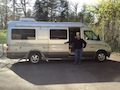
    My favorite vendor was Bike Friday, maker of the hand-built and customized folding bike you see me riding in the photo above. Bike Friday is an Oregon company and I was amazed at how well the small-wheeled bikes performed. They were fast, nimble and very comfortable. Both Jennifer and I bought one. From our Roadtrek Facebook Group, Jim Langely, a fellow Roadtrek owner and one of the top experts on cycling and all things that have to do with bicycles (see his books) gave me a thumbs up on the brand.
    I’ve been looking for a way to add more exercise to our traveling and these bikes, which fold up so compactly, will get me moving. I’ve been trying to figure out for some time how we could take our bikes and once I saw how these fit so well in our StowAway2 cargo box, it was a no-brainer.
    I rode it all around the campground last night. I can’t wait til I get it out in the boondocks.

    Jennifer and I each got a Bike Friday.

    My new Bike Friday

    Mine and Jennifer’s new Bike Fridays in our StowAway cargo box.
    The expo of RV related accessories, services and parts is always a big draw. I bought yet another supposedly kinkless water hose and some Velcro strips to keep it neatly and tightly wound. We’ll see. I am vowing to wind this new one correctly, the same way, every time.
    Roadtrek is here, showing off the entire line. The local dealer is Guaranty RV Supercenters from Junction City, OR and I got a chance to visit with Sales Rep Matt Elliott. He says the Pacific Northwest and the whole west coast is a strong area for Class Bs thanks to the abundance of awesome places to camp, from Pacific shorelines to mountain boondocking. Roadtrek’s sales manager and VP Paul Cassidy is also here, along with Dawn and Alex from the Kitchener team. They stopped by to chat with some of the Roadtrek owners after the motorhome showcase displays closed for the night.
    I looked but if there were other small motorhomes on display at the show here, they were hidden among the Class A skyscrapers.
    Besides the new motorhomes and the vendor display there are seminars throughout the day, dozens of them on every possible topic of interest to RVers, from traveling to Alaska, to how to do basic repairs ,to technology for travelers ,to the pros and cons of fulltiming. I taught two seminars this week, one on smartphone apps for the open road and and one on the history of the Oregon Trail.
    Jennifer and I met lots of folks interested in our Roadtreking experiences over the past couple of years. We did a lot of explaining how the two of us and our dog, Tai, manage to live in a 24 foot van.
    I like to send them to this story about our top 10 rules for getting along in a motothome.
    Rallies like this are a great time to connect with the larger RVing community, be they in Class A , C or B motorhomes. It reminds me if the pioneer mountain men who spent most of the year in the wilds, trapping and hunting and alone in the wilderness. Once a year, they’d gather for a reunion and gathering.
    While they preferred solitude and independence most of the time, connecting with their extended community from time to time was always a highlight of the year for them. So it is for Jennifer and I and the FMCA reunions like this one.
    We’re leaving here for Glacier National Park. Back to the wilds. But we’re refreshed and energized by the camaraderie we just experienced.
  2. Roadtrekingmike
    The Oregon Trail, and the ancillary trails that led from it, constituted the single greatest migration in America – as many as a half a million men, women and children who traveled by wagon and by foot west for two decades in the mid-19th Century.
    There are lots of books on the trail and lots of academic experts. But when it really comes to knowing the trail and experiencing it, there are few who can match Morris Carter.
    Morris Carter has not only built wagons that replicate those used by the pioneers, he’s actually made the 2,600-mile wagon train trip himself, from its start in Independence, Mo., to the final destination in Oregon’s Willamette Valley. That 1993 trip was followed by a similar trip in 1999 along the 2,500 miles of the California Trail.
    Others may have read the books and journals of those original pioneers, but Carter – who has also read them all – has done it. Really done it, in a wagon pulled by horse along the same routes used by those who settled the west.
    And today, from his home in Casper, Wyo., he leads modern-day wagon trail excursions whose route literally parallels the still-visible ruts left by those who traveled the Oregon Trail 150 years ago.
    His trips range from four hours to overnights and week long trips, with those who travel with him staying overnight in Tee Pees, fed Wyoming steak dinners around a campfire and regaled with Carter’s encyclopedic knowledge of what it was really like to make the trip, which typically took six more months.
    Here’ a video I did of the covered wagon trip.

    Jennifer and I tagged along on a tour. I hopped in and out of the wagon, taking photos and shooting video. Carter’s daughter, Oneida, who accompanied her father on the full-length Oregon Trail trip in 1999, expertly handled the two draft horses. The trip was booked by a family of four from Oklahoma, Mark and Nikki, their 16-year-old daughter Rebekah and seven year old son, Blaney.
    “There are a lot of misconceptions about the Oregon Trail,” Carter told me. “It wasn’t just one wagon most families took. It was two or three. They took everything they had to set up and furnish their new homes in the west. And the trail was usually crowded. The string of wagons often stretched out as far in front and in back as you could see. The wagons would be sometimes 10 across. They’d average two miles an hour when pulled by oxen, maybe four if by horses.”
    As I walked along taking photos, he repeatedly warned me to watch for rattlesnakes. I didn’t see any. Thankfully. “They’re all over out here,” he said. “Fortunately, they’re watching for you, too.”
    No wonder Jennifer decided to stay in the wagon.
    In the original migration, most people walked, Carter said, making it easier on the animals. “Some walked the entire way,” he said. “many were barefoot.”
    The biggest danger was accidents. Falls off wagons, under wagons, being tramped or kicked by a horse, snakebite. Disease was widespread, especially cholera. There was a saying the pioneers had about the thousands who died from the virulent intestinal disease: “Healthy at breakfast, in the grave by noon.” Indeed, as Jennifer and I have visited various spots along the Oregon Trail from Missouri westward, we have seen several grave sites of pioneers who died along the trail of the disease.
    There were also Indian attacks. One wagon train was wiped out just a couple of miles from the route we traveled. That same band of Indians also killed an entire cavalry platoon sent out to protect the ill fated wagon train.
    What amazed us as we rode the wagon across the countryside was how hilly it was. The tall prairie grass makes it look flat and smooth from a distance. Up close, it is a bone-jarring bumpy ride that constantly seems to be rising and falling.
    At camp, we joined the family for dinner, steaks grilled over a campfire, baked potatoes, rolls, green beans and bacon, and cherry cobber baked in a Dutch Oven. As they retreated to their Tee Pees after dark, we went to our Roadtrek Etrek, which we had driven out to the prairie campsite.
    In the morning, I took photos of the replica of the original two-horsepower covered wagon next to my modern covered wagon with diesel power.
    Over coffee that morning, before the guests left their sleeping bags in their Tee Pees, Carter told me he was looking for help in running his expeditions and though a workcamping RV couple would be perfect to help drive the wagons, care for the horses and prepare the meals. He has full hookups on his property. I promised to put the word out….. which I just did.
    The trip was one of the most interesting and enjoyable things we’ve ever done. The prairie is beautiful, even when dark clouds bearing lightning and a sudden downpour swept down over the mountains. It has a vastness about it, like the ocean, spreading out wide and full beneath a big sky that bottoms out against a range of low lying mountains. Antelope bound over the little grass hills, eagles float overhead.
    I’d highly recommend the experience though you need to be in half way decent shape without back or neck problems. Those wagons are pretty bouncy and riding a horse for extended periods of time does require a basic level of physical health.

    With daughter, Oneda, driving the wagon, Morris Carter (right) rides alongside. The wagon is on the original Oregon Trail, the ruts of which can still be seen on the Wyoming prairie.

    The Wyoming prairie is stunningly beautiful.

    Rain sweeps towards us from distant mountains as the sun still shines in the foreground.

    Morris Carter

    Jackie, who works with Carter, made a campfire steak dinner.
  3. Roadtrekingmike
    When we talk about boondocking in an RV, we usually mean dry camping, off the grid camping in out of the way, wilderness areas, far from civilization and deep in the boonies.
    Indeed, for Jennifer and I, that is our favorite place to be.
    But that’s not the only place to be.
    As I write this, we just spend a night boondocking in the parking lot of a hotel near Memphis, Tenn.
    It was a quiet, peaceful night. We parked in an out-of -the-way spot in our Roadtrek Etrek. It was typically hot, as it always is in late July in the south. The outside temperature barely dipped below 80. We fired up the Etrek air conditioner and let it run a couple of hours. It got so cold we turned it off a little after midnight. Then we opened the widows, opened the roof vent and turned on the Fantastic Fan. We also used a small oscillating fan we plugged into an AC outlet.
    We slept like babies all night.
    Let me say right now that such boondocking is controversial.S ome RVers do this regularly, albeit clandestinely. They just pull in, and go to sleep. That’s the beauty of a Class B. It is not like those Class A skyscraper-on-wheels accompanied by a towed vehicle. Or even those boxy, bloated Class Cs and B-plusses. A Class B like our Roadtrek is basically a very stylish van. It doesn’t draw attention to itself and it fits right in with the mother vehicles in a parking lot.
    Jennifer and I always get permission first.
    In this case, we are down in Memphs with our son and his family to watch the Dizzy Dean Little League team he coaches play in the World Series. Our eight-year-old grandson, Jacob, is on the team and we will be cheering him on. The whole team is staying at a hotel in Germantown outside of Memphis and we, too, have a room booked for most of the week.
    We boondocked in the parking lot because we arrived a day early and our room was not ready. The hotel manager gave us permission.
    Could we have done so without permission? Probably. I doubt whether anyone would have noticed. But I just think it’s better to ask.
    We have stayed before in parking lots like this. A couple of weeks ago in Ludington, MI, we slept in the parking lot of a car ferry that we had booked passage on the next day to cross Lake Michigan. A week or so before that, we overnighted in a parking lot of a ski resort in Minnesota. We asked and received permission for both. In a small town in central Nebraska, we asked the local police where we could overnight. They directed us to the parking lot of the town park and baseball diamond.
    Others have shared with us how hospitals are also good places to boondock. In the morning, there is the cafeteria to stay in. And, of course, there are places like Cabellas, Cracker Barrel, Wal-Mart and other businesses that welcome boondockers like casinos and truck stops.
    We’ve written before about the Free Overnight Parking wesbite.
    But here, I think, is an even cooler resourse - a network of RV owners who welcome boondockers to spend the night on their property.
    The very excellent Boondockers Welcome website is devoted to just that. Through the website, you can connect with other RVers who have a location for you to dry camp for the night; it might be in their driveway or a field on their farm. The view may be of amber waves of grain or of the McDonald’s parking lot… but it will be a free place to park where you don’t have to worry about idling truck engines, security, or that dreaded knock on the window at 2 AM. For full access to that site, they charge $20 a year if you will offer free boondocking on your property, $25 a year if you don’t.
    “Many of our members have reported that the social element of meeting fellow members is as important as the free parking,” says three time Roadtrek-owner Marianne Edwards, who co-founded the site with her husband. “Many of our hosts offer electric, water, and occasionally even an RV dump as well. They can provide advice about their area, lend a tool if you need one, suggest the best local places to shop, eat, buy fuel, and offer sage advice to new RVers. Single women have told us they feel much more secure parked with our hosts than they do in a retail parking lot.”
    You can check out a lot before signing up for a membership
    “Anyone can go onto the website and see all the details of every listing before joining – so you know exactly what you`re going to get,” she says. “Only thing you can`t do without a membership is contact fellow members, write recommendations for each other, or participate in the forums.”
    It’s a great site, run by folks who understand RVers and boondockers.
    When Marianne and her husband are not on the road themselves, they personally offer overnight parking for RVers (members as well as non-members) passing through their hometown of Elora, Ontario, Canada.
    Now before I end this post let me say that I am not against campgrounds. There are some who get furious every time I write about this. Some Campground owners and others who think everyone should do exactly as they do and they get get all bent out of shape by the idea of boondocking. They like camping in narrowly spaced little organized lots surrounded by thick smokes from three dozen campfires. If that’s you, enjoy.
    We use campgrounds all the time. Most we like.
    But there are times – when campgrounds are crowded, when you are just in need of a fast overnight stop while traveling, when there are no campgrounds nearby – when overnight dry camping is what you want and need.
  4. Roadtrekingmike
    Sometimes, as we Roadtrek across North America in our RV, we run into stories that are so amazing that you don’t know how to categorize them. So it was with us in downtown Kansas City when we toured one of the most fascinating museums we have ever seen.
    It’s a museum devoted to the Steamboat Arabia, which sunk after running into a tree snag in the muddy Missouri River on September 5, 1856 as it was carrying 200 tons of supplies destined for a string of frontier towns to the west.
    But like the fabled King Tut’s Tomb, the recovery of the Arabia and the cargo it was carrying almost defies belief. The Arabia’s wreckage contained the largest single collection of pre-Civil War U.S. artifacts ever discovered – remarkably preserved clothing, tools, guns, dishware, window glass, candles, jewelry, wine and other everyday items that serve as a time capsule of life on the American frontier. There are even bottles of still pleasantry fragrant 19th century perfumes.
    But I don’t know if it’s the amazing items found in the wreckage or the actual discovery and retrieval of those artifacts that is the most interesting.
    Because the Arabia was discovered not at the bottom of the Missouri, where she sank, but 45 feet down in the idle of a Kansas cornfield a half mile from the current banks of the river.

    I took this photo from a display at the museum showing the partial excavation.
    More than 400 steamboats have sunk in the Missouri over its 2,500 mile course. Most are undiscovered.
    The Arabia was a side-wheel steamer, carrying passengers and cargo on a regular route and schedule. At 171 feet long and capable of carrying 222 tons, she was a medium-sized boat. Her trade route took her well into present-day South Dakota. On September 5th, 1856, six days after departing St. Louis heavily loaded with freight and passengers, the Arabia reached Kansas City, Mo.

    Another excavation shot from the museum

    The only casualty was a mule. The passengers were all offloaded onto a skiff before the Arabia sunk.
    Following a short stopover the side-wheeler was again underway to her intended destinations. A short distance upstream was the town of Parkville, Mo. But the Arabia would never arrive. During the night, the steamer struck a sunken snag, below the surface of the river. Within minutes much of the boat and virtually all 222 tons of precious frontier cargo lay at the bottom of the Missouri River.
    Although the Arabia went down in 15 feet of water, all of its 130 passengers reached shore on the ship’s skiff—the only fatality was a mule tied to the deck. The skeleton of that mule is on display in the museum.
    The river bottom was soft, and the boat and cargo sank quickly into the mud and silt. The boat held merchandise bound for frontier stores, and personal belongings of the passengers. Eventually, all evidence of the Arabia was erased from view. Seasonal flooding covered the site, and in its wake was deposited layer upon layer of rich, black topsoil.
    Bob Hawley is a local amateur treasure hunter who, with sons David and Greg, became obsessed with the story of the Arabia and its mystery cargo. It was rumored to have a huge cargo of Kentucky Bourbon and gold. Hawley knew that the Missouri had a shifting channel and that it had moved considerably east over the years and using a metal detector, weathered maps and old newspaper clippings, he persuaded a Kansas farmer to let them search the field. In 1987, his metal detector pinged off the big boilers of the Arabia and, in four months time, Hawley and the group of family members and several friends, excavated it.

    Bob Hawley still hangs out at the museum, meeting visitors.
    The mud remarkably preserved the wreck. There was, it turned out, no gold. And the bourbon was never found. Hawley suspects opportunists grabbed it from the decks the day after the Arabia sunk. But what was aboard has fascinated visitors and students of the American west for more than two decades now.
    I met Hawley the day I visited. He still hangs out at the museum. He said there have been many offers to sell the artifacts from private collectors over the years he believes they should be shared with the public.
    Jennifer and I spent half a day at the museum, marveling at the displays. Only about half of what was discovered is shown.
    The museum is still cleaning, cataloging and preserving the rest of the items. Visitors can actually observe the process, as its all done in the open.
    The museum is open seven days a week, Admission is $14.50 for adults and worth every sent. Seniors get a buck discount.
    There’s parking in the area in front of the museum suitable for a Class B RV. Anything bigger will have to park somewhere else in the congested downtown area. The address is 400 Grand Boulevard, Kansas City, MO 64106.
    Here are some photos of the artifacts:

    Dishware from the Arabia was bound for frontier towns.

    Knives that would have been used on the frontier.

    Shoes and boots that never made the waiting frontier towns.
  5. Roadtrekingmike
    Sometimes, as we Roadtrek across North America in our RV, we run into stories that are so amazing that you don’t know how to categorize them. So it was with us in downtown Kansas City when we toured one of the most fascinating museums we have ever seen.
    It’s a museum devoted to the Steamboat Arabia, which sunk after running into a tree snag in the muddy Missouri River on September 5, 1856 as it was carrying 200 tons of supplies destined for a string of frontier towns to the west.
    But like the fabled King Tut’s Tomb, the recovery of the Arabia and the cargo it was carrying almost defies belief. The Arabia’s wreckage contained the largest single collection of pre-Civil War U.S. artifacts ever discovered – remarkably preserved clothing, tools, guns, dishware, window glass, candles, jewelry, wine and other everyday items that serve as a time capsule of life on the American frontier. There are even bottles of still pleasantry fragrant 19th century perfumes.
    But I don’t know if it’s the amazing items found in the wreckage or the actual discovery and retrieval of those artifacts that is the most interesting.
    Because the Arabia was discovered not at the bottom of the Missouri, where she sank, but 45 feet down in the idle of a Kansas cornfield a half mile from the current banks of the river.
    Over 400 steamboats have sunk in the Missouri over its 2,500 mile course. Most are undiscovered.
    The Arabia was a side-wheel steamer, carrying passengers and cargo on a regular route and schedule. At 171 feet long and capable of carrying 222 tons, she was a medium-sized boat. Her trade route took her well into present-day South Dakota. On September 5th, 1856, six days after departing St. Louis heavily loaded with freight and passengers, the Arabia reached Kansas City, Mo.
    Following a short stopover the side-wheeler was again underway to her intended destinations. A short distance upstream was the town of Parkville, Mo. But the Arabia would never arrive. During the night, the steamer struck a sunken snag, below the surface of the river. Within minutes much of the boat and virtually all 222 tons of precious frontier cargo lay at the bottom of the Missouri River.
    Although the Arabia went down in 15 feet of water, all of its 130 passengers reached shore on the ship’s skiff—the only fatality was a mule tied to the deck. The skeleton of that mule is on display in the museum.
    The river bottom was soft, and the boat and cargo sank quickly into the mud and silt. The boat held merchandise bound for frontier stores, and personal belongings of the passengers. Eventually, all evidence of the Arabia was erased from view. Seasonal flooding covered the site, and in its wake was deposited layer upon layer of rich, black topsoil.
    Bob Hawley is a local amateur treasure hunter who, with sons David and Greg, became obsessed with the story of the Arabia and its mystery cargo. It was rumored to have a huge cargo of Kentucky Bourbon and gold. Hawley knew that the Missouri had a shifting channel and that it had moved considerably east over the years and using a metal detector, weathered maps and old newspaper clippings, he persuaded a Kansas farmer to let them search the field. In 1987, his metal detector pinged off the big boilers of the Arabia and, in four months time, Hawley and the group of family members and several friends, excavated it.
    The mud remarkably preserved the wreck. There was, it turned out, no gold. And the bourbon was never found. Hawley suspects opportunists grabbed it from the decks the day after the Arabia sunk. But what was aboard has fascinated visitors and students of the American west for more than two decades now.
    I met Hawley the day I visited. He still hangs out at the museum. He said there have been many offers to sell the artifacts from private collectors over the years he believes they should be shared with the public.
    Jennifer and I spent half a day at the museum, marveling at the displays. Only about half of what was discovered is shown.
    The museum is still cleaning, cataloging and preserving the rest of the items. Visitors can actually observe the process, as its all done in the open.
    The museum is open seven days a week, Admission is $14.50 for adults and worth every sent. Seniors get a buck discount.
    There’s parking in the area in front of the museum suitable for a Class B RV. Anything bigger will have to park somewhere else in the congested downtown area. The address is 400 Grand Boulevard, Kansas City, MO 64106.
    Here are some photos of the artifacts:
  6. Roadtrekingmike
    We’ve now officially begun our trip west, a journey that will follow parts of two historic routes: The Lewis and Clark Expedition and the Oregon Trail.
    It’s hard to over emphasize the importance of these two 19th century routes. Lewis and Clark discovered the overland route to the Pacific, thus opening up the nation to east-west travel in the days immediately after the Louisiana Purchase. It was a trip that in its day, was as monumental as the American landing on the moon is to ours.
    The 100,000 Oregon Trail pioneers came four decades or so later in their prairie schooners – so named because their wagons were covered with white canvas that made them resemble a ship at sea. Others took routes that sprang off the Oregon Trail on paths called the California Trail and the Mormon Trail as the headed to the Gold Rush and Sat lake City.

    Lewis and Clark and the Corps of Discovery took a keelboat down the Missouri.
    Retracing those routes in our Roadtrek Etrek RV – the modern equivalent of a covered wagon – is a trip Jennifer and I have wanted to take for years. So from now till early September, we’ll be visiting places where the ruts of those wagons can still be found, seeing the places where history was made and learning about the vastness of our country and the amazing adventures caught up in that great western migration.

    Confluence Point – where the Missouri River (top) flows into the Mississippi in St. Louis.
    It all starts with the wide Missouri. At 2,341 miles, the Missouri River is the longest river in North America. It is impressive to behold. But what you see today is much less than 19th century explorers and pioneers encountered. We have messed it up through channelization and dam building, greatly changing the Missouri River. Today, 67 percent of the Missouri is either channelized for navigation (650) miles or impounded by dams (903 miles). Most of the remaining free-flowing portions of the river are near the headwaters in Montana. Channelization has resulted in the lower river being about 50 percent narrower.
    But like I said, it is still impressive. But realizing that it was bigger and wider and wilder 200 years ago makes you wonder how these early explorers did it.
    Nicknamed the “Big Muddy,” the Missouri River has long been one of North America’s most important travel routes. Every bend in the river is saturated in history. Her waters saw the canoes of many American Indian tribes, fur trappers, explorers and pioneers. The river served as the main route to the northwest for Lewis and Clark and later became the primary pathway for the nation’s western expansion. The Missouri has witnessed the rise and fall of the steamboat era and given birth to countless communities that settled near her banks.
    It has meandered all over the place Some parts of the river have moved as much as two miles from their course during the early part of the 19th century. It has a powerfully strong current that those heading west paddled and poled against. And it was always dangerous because of snags and floating debris and sandbars that stranded many a traveler.
    We started our tour in St. Louis, where the Missouri dumps into the Mississippi at a place called Confluence Point. Standing at the point where the nation’s mightiest two rivers merge, it’s hard not to think of all the dreams, all the hopes and aspirations that welled up in the hearts of those who came this way in the 1800′s. Lewis and Clark and the Corps of Discovery took the Ohio River to the Mississippi, then the Mississippi to the Missouri, beginning their official expedition of the west from this very spot in May of 1804.
    A great book that we are reading as we head west is Robert Ambrose’s Undaunted Courage. It’s the definitive work on the expedition and fascinating reading. I wish we had an audio version so it could play as we are driving. But it was unavailable when we ordered so we sometimes take turns reading aloud from the big paperback to each other.
    A hundred miles west of St. Louis, we did our first overnight at a place called Arrow Rock, MO, a dozen or so miles north of I-70 near the Missouri River. At this quiet, peaceful park, there’s a monument overlooking a spot where, early on, Lewis and Clark faced their first of many dangers – huge floating trees that had toppled into the river when the Missori currents undercut the banks they were growing on and threatened to smash their keelboat to bits.

    Lewis and Clark almost lost the keelboat at a spot near Arrow Rock just three weeks after departing St. Louis.
    The Arrow Rock State Historic Site here has a restored village and great camping. The campground is small, only 47 sites and fills up most weekends. We had no trouble getting in midweek.
    The village of Arrow Rock was the traditional starting point for another historic trail – The Santa Fe Trail. In fact, as we move west, off the interstates and through the plains and into the Rockies, we’ll see several other trails all using parts of these same routes, the California Trial, the Mormon Trail and the Pony Express Trail.

    Missouri Highway 41 follows the Lewis and Clark trail.
    We found Arrow Rock a great place to read, research our route and, thanks to a great Visitor’s Center, immerse ourselves in what life was like when, in the early 1800s, this was the last city on the western frontier.

    The old Huston Inn at Arrow Rock is still open.
    Named because of a tall sandstone bluff on the Missouri that the Osage Indians used to chisel out flint for arrow heads, Arrow Rock once had 1,000 residents. Today, 56 live there. In the summer, there’s a professional theater – the Lyceum – that brings in tourists each day.We watched a production of Agatha Christie’s Witness for the Prosecution and noted, as we returned to camp late that night, that many of our neighbors ha also been at the play.
    And the historic Huston Tavern, established in 1834, is the oldest continually serving restaurant west of the Mississippi. We found excellent, family style food, especially the fried chicken, raspberry glazed ham, mashed potatoes, corn, biscuits and cobbers to die for..

    The Missouri River near Weston, Mo. The wilderness terrain is much the same today as then.
    We liked Arrow Rock so much we set three nights, soaking up the landscape, thinking about what it must have been like for those pioneers so long ago who set off from the very place we were parked beneath s cottonwood tree in our air conditioned Roadtrek.
    Not quite the same, to be sure.

    Made for a movie, this 55-foot replica of the Lewis and Clark keepboat invites exploration by today’s visitors to the Lewis and Clark Discovery Center in Nebraska City.
    We left Arrow Rock and continued west, past Kansas City, following the Missouri to the Weston Bend State Park near the town of Weston, once a thriving river town now – thanks to the river’s shifting banks – more of a trendy little place of antique shops and bed and breakfasts.
    We overnighted at the Weston Bend State Park and watched the sunset at a Missouri River overlook where the Corps of Discovery set shore for some exploring.

    Lewis’s branding iron at the Lewis and Clark Discovery Center in Nebraska City.
    The next day it was north and west to Nebraska City, NE and the Lewis and Clark Discovery Center on the river there. The center itself wasn’t much. Mostly some displays, including a branding iron owned by Lewis and used to emblazon trees along the route.
    The thing that most interested me was a full-sized replica of the 55 foot long keel boat used by the expedition to navigate the Missouri. Originally made for a movie, it sits out front of the center and allows visitors to come abroad. I grabbed one of the oars of the same type and size used by the crew and was amazed by how heavy it was and could only imagine what it would ave been like pulling it hour upon hour against the currents.

    The Missouri River is called Big Muddy” and even today, as seen from Nebraska City, it looks much like it did in Lewis and Clark’s time. Note the snags and driftwood on the opposite bank.
    There’s a shore trail that leads do yet another river overlook that made for a nice photo op. The river is still muddy and the current is obvious. The banks of the Missouri remain littered with snags and driftwood.
    From Nebraska City, we took NE-2 west through rolling cornfields, slowing moving past the Missouri and closer to the Oregon Trail, which we’ll be following over the next several days.
  7. Roadtrekingmike
    The surveys show well over 75% of all RVrs travel with dogs. In fact, many said because they want to take their pets with them is one of the major reasons they bought an RV in the first place.
    Jennifer and I are the same. We enjoy the company of our Norwegian Elkhound, Tai, and bring him with us on most of our trips.
    But there are times while we’re on the road that Tai doesn’t quite fit in.
    Take the long trip west that we’re now on.
    Tai will be great for most of it. But the first part, a week in suburban Memphis where of right-year-old grandson was in a sports tournament, posed a major dilemma. We were staying with the rest of the team parents and grandparents in a hotel where dogs were not allowed. And the sports complex where the games were being played did not allow dogs in the grounds.
    Added to that was the notorious Memphis heat. The temperatures were in the mid 90′s each day, with heat indexes well over 100. So leaving him in our RV, even with the air conditioning running, just wasn’t a good idea. If that AC should fail, the heat buildup inside the coach would would be potentially fatal.
    We thought of leaving him 1,000 miles away, back in Michigan. But to take him on the trip west, which was to begin once the tournament ended, would have meant 1,000 miles back north, before we could start west.
    I posted our dilemma on our Roadtreking Facebook Group. And among lots of suggestions we received, one turned out to be perfect.
    A website called DogVacay, short for Dog Vacation, which lists thousands of trusted, licensed dog sitters who are willing to board pets in their own homes, just as if they were members of the family.
    Just to see what it was like, I plugged in the suburban Memphis city where we would be spending most of our time watching the games. You can imagine my surprise when the DogVacay sitter we choose turned out to live directly across the street from the ballpark.
    Sophia Townsend was her name and, with her husband, Gordon, she watched Tai all week. We even saw her walking Tai one afternoon and rushed over to say Hi.
    The Townsends live in a ranch-style home on a corner lot of a well kept subdivision and has a large, well manicured backyard surrounded by a tall fence, though in the Memphis heat, Tai much preferred the air conditioning inside.
    I can’t begin to say how thrilled we were to have found the loving dog sitters Sophia and Gordon and DogVacay.
    As we continue our travels across the country, I’m sure there will be other occasions when we’ll use it again.
    To use the service, you have to register for a free account You upload a photo of your pet and answer some questions about his temperament. Rates are $25 day. Other services like play time, walks, even grooming, can also be arranged. Your dog’s host family will even send you a daily note and photo of your pet, if you so desire. Each dog that is booked through DogVacay.com is covered under insurance policy that includes $25,000 in dog medical coverage in care, custody and control of the host, less a $250 deductible.
    The service also has a PAWtastic partnership with VCA-Antech, the largest veterinary group in the country to help handle any veterinary issues.

    Tai was welcomed on the couch. That's Gordon and Sophia and two of their four dogs that made Tai feel like one of the pack.
  8. Roadtrekingmike
    Of all the eight states that touch the Great Lakes , Michigan – with 2,147 miles – has the most coastline. So as we rounded the bottom of Lake Michigan from the Indiana border and made our way into Southwest Michigan on the last leg of out 10-segment adventure, there was a sense of déjà vu about it all.
    Around us were beautiful blue waters, sand dunes, lush green agricultural fields and even a wine trail, much like we have seen to different degrees on all of the lake shorelines we’ve visited over the past month on our Verizon Great Lakes Shoreline Roadtreking Tour.
    Here’s part 10 in our videos:

    And yet, there was an entirely different feel to this stretch of shoreline.
    Seemingly every few miles were broad, sugar sand swimming beaches that put anything in California to shame. A series of welcoming beach towns – Grand Haven, South Haven, Saugatuck – are right on the shore, with trendy shops and restaurants just a couple blocks east of the lake.
    Southwest Michigan and the lakeshore is also known for its vineyards. Acre after acre… so many, there’s even a shoreline wine trail that draws fans from across the country.
    But then, along I-94 we saw a billboard promoting a place called The Chocolate Garden, a place the Food Network has raved about, a place voted as the Number 1 chocolatier in America, located in the town of Coloma, a mile off the interstate.
    The best? How could that be, especially in a, well, an obscure place like Coloma.
    Turns out it is a technology story.
    Tina Buck, the owner, is a former advertising and marketing exec who started a small online business from her home making chocolate truffles. Not just any chocolate truffles, mind you. She has some secret ingredients and a way of cooking them that made her chocolates to die for.
    People slowly started ordering them off the Internet. Then the Food Network found out about them and, blown away by Tina’s chocolates, did a full blown story praising them. Then came the Best of America Award as the best chocolatier in America and the Chocolate Garden was on the map.
    People started showing up in Colima, looking for her. But she had no building. She handled it all in the kitchen of her home. Because of the demand, she built a small little store and that’s where we found her, selling the best chocolates I have ever sampled. We liked them so much we spent $130 and walked off with a shopping bag of them.
    “Technology has been crucial to our success, especially the Internet,” she said. “That’s what made all this possible. That’s how we got our start.”
    She relies on Verizons 4G LTE network and an Air Card to provide redundancy to her network. “It’s actually our most stable connection,” she said.
    The shoreline tour came to an end just south of Ludington MI. We had come down that far on an earlier leg, before crossing over to Wisconsin on a car ferry.
    In all, we drove the coastline of all five Great Lakes, traveled 4,062 miles and visited eight states across two time zones.
    I invite you to follow in our tire tracks.

    Southwest Michigan vineyards

    Tina Buck makes the best chocolate in America!
  9. Roadtrekingmike
    The one thing we have learned on this Verizon Great Lakes Shoreline Roadtreking Tour is that very often, a surprise is literally around the next corner.
    So it was when we got off the car ferry in Manitowoc, WI, directly across Lake Michigan from Ludington, MI
    As we made a right turn out of the parking lot, we spotted a submarine. What on earth is a submarine doing in Manitowoc, WS? We had to find out. The sub is docked out front of the Wisconsin Maritime Museum, a fascinating place dedicated to the maritime history of Wisconsin and the Great Lakes region.
    It turns out that the city of Manitowoc, WI built 28 sumarines for service in World War II. In all, more than 7,000 men and women worked around the clock, 365 days a year to build some of the best submarines in the Navy. Of the 28 submarines, 25 were built in time to see action during the war. Together they sank 132 Japanese ships.
    Just up the shoreline in Two Rivers, WI, we found another place of great historical significance about something very near and dear to us. Twi Rivers is recognized by the Wisconsin State Historical Society as the REAL birthplace of the ice cream sundae.
    I stress REAL because lots of other communities around the country have tried to claim that title. But well-known American language authority, columnist and author H.L. Mencken identified Two Rivers as the birthplace of the sundae. The claim is also supported by a 1929 newspaper interview in which the inventor recalls how the sundae came about.
    For me, it was a chance to visit the Ice Cream Sundae Museum there and order one. It was a piece of art. Two scoops of vanilla ice cream with caramel and chocolate sauce, whipped cream and a maraschino cherry.
    I love my job.
    Heading south, we came to Wisconsin Cheese country. Called America’s dairy state, Wisconsin has a rich tradition of cheese making. In the crossroads town of Gibbsville, the VanTatenhove family has owned place and been making cheese for generations. I sampled the extra sharp cheddar.
    Have I told you I love my job?
    Here’s the video we put together for this:
    A lot of folks have emailed me asking how we find all the interesting spots we’ve been visiting. Many times, it’s just a roadside sign or an email suggestion from a reader or our curiosity. But I have some apps on my smartphone that we use. Thanks to the solid Verizon 4g LTE signal we’ve had for most of the tour, those apps have really helped.
    Here are the three apps I’ve used the most:
    Roadtrippers- Search along a route or plan a road trip with their online trip planner for free, then sync it with your smartphone for turn-by-turn navigation. Roadtrippers is a powerful route planner, perfect as a RV trip planner or family trip planner, listing all the cool, offbeat and major tourist events for you to visit on your roadtrip.
    Field Trip – This is a very handy and totally free app from Google for the iPhone and Android devices. The app bills itself as a tool to find cool, hidden, and unique things in the world around you. And that it does, Field Trip give you inside info on everything from local history to the latest and best places to shop, eat, and have fun. You select the local feeds you like and the information pops up on your phone automatically, as you walk or drive. When you get close to something interesting, it will notify you and if you have a headset or bluetooth connected, it can even read the info to you.
    Around Me App. It is all about providing local info. Whatever you’re looking for -grocery stores, banks, hospitals, gas stations, movie theatres. This is really handy when you travel, but surprisingly useful locally, where I always seem to find cool things nearby that I didn’t know about. It’s free for Apple, Android and Windows devices and smartphones.

    The city of Manitowoc, Wisc., built 28 submarines during World War II and has a great maritime museum.

    Lake Michigan shoreline
  10. Roadtrekingmike
    Our Roadtrek Etrek now has its sea legs.
    Sometimes, to really appreciate something, you have to immerse yourself in it.
    So it was with Lake Michigan as we’ve been traveling around the Great Lakes Region these past several weeks on our Verizon Great Lakes Shoreline Roadtreking tour.
    No, we didn’t go swimming in it. The heavy ice up this past winter has left it and the other four Great lakes, abnormally cold. And normal is cold. This summer, it is really cold.
    So instead of getting wet in the lake, we crossed it.

    Bright and early on a recent Wednesday morning, our Roadtrek Etrek motorhome backed aboard the SS Badger, the largest car ferry steamship in the Great Lakes, measuring over 410 feet and able to hold 180 vehicles and 600 passengers.
    We took the 8:30 a.m. crossing, arriving the night before and boondocking in the Roadtrek in the carferry parking lot in Ludington.
    On the day we crossed, it was about half full. The ferryboat line suggests you call ahead to let them know you’re coming, especially if you are traveling in an RV. Size is not a problem. They seldom run out of room. They just like to know what to expect. On the day we crossed, there were Class A, Class C and Class B motorhomes aboard. There was even a huge truck semi-tractor trailer combo.
    We had Tai with us. Dogs are not allowed on the upper deck passenger areas. There are kennels for pets down in the vehicle parking area but most people chose to do what we did, crack a window and leave their pets in their vehicle. Tai slept soundly in the Roadtrek. There’s a fresh sea breeze down there so heat is not an issue.
    Our route traveled 60 miles in a straight line across Lake Michigan from Ludington, MI to Manitowoc, WI. Passengers sped their time doing all sorts of things. On nice days, they sun themselves on the forward deck. Inside, the ship offers bingo, movies, a arcade, TV and even satellite Internet Wi-Fi.
    Jennifer and I were given a bow to stern tour of the big ship – in consideration to be a National Historic Landmark.
    In the engine room, the massive steam engines run so smooth you can balance a nickel on them.
    To really appreciate the size of Lake Michigan, you need to be in the middle of it. It fills the horizon, as far as you can see in any direction, the only Great Lake entirely within the United States, touching the borders of four states.
    We even had a stateroom aboard the Badger. I grabbed an hour long nap as the big ship cut across two and three foot waves. I slept like a baby, rocked gently by the ship.
    The trip took four hours from shore to shore, four relaxing, stress-free, very enjoyable hours.
    How much does it cost to cross? Check out the schedules and fares page for the Badger. Our Roadtrek was considered a van. That’s $132 for a round trip. We elected for one-way as we did some exploring down the Wisconsin coast and hit Illinois and Indiana. The one-way cost is $66. Bigger Class C and Cass A RVs are usually priced by the foot, $5.95 per foot one way, $11.90 a foot round trip. That’s the same rate for passengers – $66 one-way. Seniors get a slight break at $62.
    There’s no charge for pets.
    The ship itself has a rich history.
    Today, it is the only coal-fired steamship in operation in the United States and has a unique propulsion system that has been designated as a national mechanical engineering landmark. It entered service in 1953, designed specifically to handle the rough conditions that it would likely encounter during year ’round sailing on Lake Michigan.
    Built primarily to transport railroad freight cars, but with lots of passenger accommodations, the Badger reigned as Queen of the Lakes during the car ferries’ Golden Era in the late Fifties, with Manitowoc, Milwaukee, and Kewaunee as her Wisconsin ports of call. By the Seventies, changing railroad economics were condemning other car ferries to mothballs or the scrap yard. With little railroad freight business left, and without ever tapping into the opportunity to serve the needs of the vacation traveler, the Badger sailed from Wisconsin to Ludington and tied up for the last time in November 1990 – signaling the end of the century-old tradition of car ferry service on Lake Michigan.
    The demise of the car ferries was devastating to the communities they had served. It seemed that the magic of these wonderful ships would only live in memory, never to be experienced by future generations. However, in 1991, an entrepreneur named Charles Conrad committed his own financial resources to reinvent the S.S. Badger to carry leisure passengers and their vehicles.
    Since then, this legend of the Great Lakes has delighted a whole new generation of people, allowing them to experience a bit of history that almost slipped away while cruising to fun destinations on both sides of Lake Michigan. The S.S. Badger now sails daily between Manitowoc, Wisconsin and Ludington, Michigan from mid-May through mid-October.

    The SS Badger is 412 feet long and can handle any sized RV.

  11. Roadtrekingmike
    Michigan’s UP is hemmed in by three of the Great Lakes. Everyone knows about Superior and Huron but the lake on the UP’s southern border has some great camping and exploring opportunities, too.
    So. after three weeks of travel on our Verizon Great Lakes Roadtreking Shoreline Tour, we have now arrived at the fifth of the big lakes – Lake Michigan.
    Lake Michigan touches four states and is the only one of the Great Lakes that doesn’t share a coastline with Canada.

    We started out following it across the bottom of Michigan’s Upper Peninsula near the Wisconsin border and because it has so much shoreline, we’ll cover it in three segments.
    You can see the first of our Lake Michigan reports and the 7th in our series by clicking above.
    Our first destination was a 17 mile long appendage called the Garden Peninsula that juts out into the UP’s Big Bay de Noc. There, we toured a ghost town of sorts, the once thriving iron smelting town town of Fayette. The state has restored many of the mid-19th century buildings.
    Today, it’s a reminder that nothing lasts forever. There’s a nice campground there with electric hookups. But there are just vault toilets, no shower facilities and there is no dump facilities. Park officials say they are planning to upgrade the campground next year, pending budget approval. But you can walk through a narrow forest and get right to the rocky shoreline. Be sure and wear real shoes instead of flip flops if you plan to walk the stone beach.
    Further east and just yards off US 2, Lake Michigan offers swimming beaches that beckon a stop by the traveler. There are several state campgrounds along the lake, too. Our favorite is Hog Island Point, a niftly little hideaway campground, nestled into the cedars and hardwoods of a small peninsula that juts into a pretty little Lake Michigan bay just off US-2, about 35 miles west of the Mackinac Bridge. There are 59 rustic sites and because of the name, perhaps, and the lack of hookups, most are usually vacant.
    Then it was across the Mackinac Bridge and the Lower Peninsula and Michigan coastal highway 119 – known as the Tunnel of Trees, one of the most scenic roads in Michigan, running 20 miles from Cross Village to Harbor Springs.
    This is the heart of Michigan’s “Up North” vacation land, characterized by the sparkling water of Lake Michigan, gently rolling hills, lots of scenery and beautiful beaches in Petoskey and the Traverse City area. As you drive south along the shore, vast cherry orchards line both sides of US 31, thriving in the unique glacial soil and climate along the Lake Michigan coastline.
    At Empire, the Sleeping Bear Dunes National Lakeshore is a true national treasure with miles of sugar sand beach, bluffs that tower 450 feet above the lake, lush forests, clear inland lakes and spectacular views that had this area named the “Most Beautiful Place in America” by the ABC Televisions Good Morning America show.
    You can even make your way down the dunes the water below… just remember, though, you’ll also have to climb back up.
    It’s also a place where the National park service is experimenting with an innovate high tech guide service that works with cellular phones at various spots along the lakeshore.
    Verizon’s robust 4g LTE network up here lets you dial in with your phone and hear interpretive descriptions of the exact location you are visiting, almost as if you had a park ranger at your side.
    This end of the tour ends at the port city of Ludington, about midway down the western shore of the Michigan Mitt.
    From there, we’ll temporarily leave Michigan and steam across the lake to Wisconsin on a 410-foot car ferry. Well tell you all about that in our next report.
  12. Roadtrekingmike
    There’s a real battle going on out there in the RV world and it pits some powerful interests against those who resent paying for services they don’t need and only want to take advantage of the generous offers of places like Wal-Mart, Cabella’s, Cracker Barrel and other businesses that not only allow but welcome brief overnight stays by traveling RVers.
    But for more than a decade now, campground owners and their national association have quietly been working behind the scenes to convince local governments to enact anti-RV ordinances that ban overnight camping in anything but a campground.
    As a result, thousands of places around North America have passed such ordinances. And more do so everyday.
    Now before I go any further, I need to point out something. I am NOT anti-campground. Neither is Campskunk or Jim Hammill or any of the other writers on my http://roadtreking.com/ blog. I use campgrounds all the time. Jennifer and I will be in one in Cape Cod next week. We have reservations over the summer at others in Ontario, Nebraska, Oregon and will likely make more. Most of the time, our experiences have been great. But it is no secret to the RVing public that many campgrounds need a lot of work. I’ve written about this before and I will continue to do so, believing exposure is the best way to force them to clean up or go away.
    What so many of us object to are discriminatory laws and local ordinances that prohibit traveling RVers from overnighting in places like rest areas, Wal-Mart parking lots and other places. I’m not talking about setting up camp, putting out the chairs, starting a campfire. I’m talking about spending a few hours sleeping overnight before hitting the road again as we are on our way somewhere. Often, we’re on our way to a campground where we’ll stay for several days. Overnight Parking is not camping, it’s parking.
    Lots of paces welcome us. Wal-mart company policy, for examke, is to allow overnight RV parking. Sam Walton, the founder, was an RVer. But astutely, we realized that the RVers who overnighted in his lot bought groceries and supplies from his store.
    But corporate policy is trumped when a local ordinance bans overnight parking.
    As we’ve dug into this, we’ve encountered some pretty powerful players aligned against free RV overnighting and behind the anti-RV laws. The biggest is the 3,000-member National Association of RV Campgrounds (ARVC). Here’s a 2011 blog report from a site that at one point reported on a database of such places, even posting the accompanying map up above.
    “One of the stated missions of ARVC is to influence legislators to institute and/or enforce parking bans in public places where RV’s are otherwise welcome. ARVC actively urges and assists members to pressure their towns to prohibit parking at public places so that RV’ers have no choice but to stay at a nearby … campground. Such parking bans extend to temporary streetside parking in some cities and towns. Not only has this has resulted in the denial of the right of private property owners to determine who shall have the use and enjoyment of their property but it has eroded our basic freedom to choose!”
    Prodded by Jim Hammill, I was going to try and develop a listing here on Roadtreking.com of all such RV unfriendly places that prohibited overnight camping.
    Turns out, I don’t have to reinvent the wheel on this.
    There already is a resource that to help you find free or very low cost places to stay while traveling in your RV. It’s called OvernightRVParking.com and it’s a labor of love for a guy named Jim O’Briant, of Gilroy, CA, who started the site in 2008. As of today, it has a database of nearly 12,000 places around North America that can be searched, listing places that allow and prohibit overnight RV parking.
    Campskunk, whose recent post on anti-RV laws in Ontario started this whole controversy on my http://roadtreking.com/ blog, has been a user of OvernightRVParking.com for years.
    The site is a subscription service – $24.95 a year.
    Plug in a city and you’ll get a map listing where you can or where you can’t overnight free or for a very low fee. O’Briant himself tries to verify every report and there are easy ways for subscribers to add to the information. He also has individual state and province pdf files that members can download to their computers if they don’t have Internet service on the road. He doesn’t recommend printing them out, as some are over 100 pages long.
    The website is tablet and mobile device friendly, so you really don’t need a special app.
    I had a great conversation with O’Briant and he has made a nice offer to readers of this blog. If you decide to subscribe to his service, he will extend your membership from 12 months to 15 months. That works out to a pretty nice discount. To get it, when you sign up and the form asks how you heard of him, type in roadtreking.com and he will automatically extend your membership.
    O’Briant is no stranger to the overnight parking ban we’ve been writing about here recently.
    “As of about 5 years ago, the ARVC website had a page discussing their ‘model legislation’ (i.e., pre-written laws that RV Park owners could take to their local city councils) and about all the support that ARVC would give to local campground owners who were working to get these laws passed in their communities,” he told me in an email. “After this became public knowledge, that part of their website disappeared (or perhaps it moved to a ‘members only’ accessible area of their site).”
    On the ARVC site now is this description of what it offers its members:
    “Powerful legislative and regulatory advocacy programs that protect your business interests. We monitor state and national policy issues that affect our industry and take action on your behalf. These efforts ensure that all of our members have a powerful voice and strong representation on the issues that matter.”
    Other big names have been lined to the controversial anti-RV parking bans based on their support of ARVC.
    “Good Sam was barraged with questions about it, as they were also accused of promoting these laws,” said O’Briant. “Their official reply was that they don’t do it. But Good Sam is (or at that time was) the largest financial supporter of ARVC.”
    Another prominent RV industry name involved in the association’s efforts is KOA. The corporate organization seems to have taken a hands -off stance on the anti-RV parking laws but individual KOA owners have and still hold leadership roles in the group.
    I signed up for OvernightRVParking.com (I paid full price, by the way) and plan to use it Friday and Saturday night as we head to Cape Cod. We’ll be in a campground Sunday-Thursday. I’ll also use it on the way back.
    Meantime, share under comments here your experiences with RV unfriendly towns. Let’s make sure we don’t spend a dime in any of them.

    There used to be a website called rvunfriendly.com. It vanished from the net, sometime in late 2011 or early 2012. But this is the map they had that shows places with RV unfriendly laws.
  13. Roadtrekingmike
    Of all the traveling we’ve done on this 4,000-mile Verizon Great Lakes Roadtreking Shoreline Tour, Lake Superior’s North Shore in Wisconsin and Minnesota has provided the most diverse scenery to date.
    Up there, as we rounded the US-side of the lake and started heading north to Canada, especially north of Duluth, we were overwhelmed by the sheer size of the Big Lake the Ojibwe call Gitchegume.
    It is so big it has tides.

    That was the first thing we learned as we moved from the Porcupine Mountains Wilderness Area at the far western end of Michigan’s Upper Peninsula into Wisconsin and Minnesota.
    At the Northern Great Lakes Visitors Center near Ashland, WI, a huge floor-mounted model of the big lake greets visitors just inside the lobby and National Park Service employees answer questions and provide orientation to the detailed displays about the Lake Superior Region.
    That’s where we learned about Superior’s tidal fluctuations – changes in water level caused by the gravitational forces of the sun and moon. To be sure, the changes are measured in inches, but the movement, sometimes aided by winds and snow melt and known as a seiche (pronounced “say-she”) is yet another Superior fact that helps us appreciate the big lake.
    The Ashland area is the gateway to yet another National Lakeshore on Lake Superior – the Apostle Islands National Lakeshore, where 21 islands and 12 miles of mainland make for dazzling displays of windswept beaches and cliffs, much like the Pictured Rocks National Lakeshore a few hundred miles east in Munising, MI.
    Ashland itself caught our eye. Beautiful murals depicting the city’s martitime history and it’s once boomtown days adorn the sides of many of the downtown buildings, The murals are huge, some two stories high, others covering almost an entire block. They are a tourist attraction in themselves.
    Wisconsin soon gave way to Duluth, MN, the port city where so many of the big iron ore and grain carrying freighters we have been seeing during our Great Lakes tour pick up their loads.
    But our first destination on the tour of Superior’s North Shore was Spirit Mountain, a ski area just outside of Duluth where we dropped in with a group of amateur radio operators to observe the old technology that led to today’s cell phone technology. Our Roadtreking Buddy Dave Miller, who we met last year while covering a dog sled race in the area, took us up to the area. We ended up spending the night there in our Roadtrek Etrek RV, boondocking in the parking lot.
    It was Field Day, an annual weekend event in which ham radio operators set up antennas and emergency-powered radio transmitter to practice their communication skills with Morse Code and single sideband voice transmission for community service deployment during times of emergency.
    “This is the technology that makes today’s smartphones possible,” said Dennis Anderson, one of the Minnesota radio volunteers. Several of the hams were using their smartphones right next to their radios, checking weather apps and checking in with social media.
    From Duluth, we headed north along the Superior shoreline. The lake is so cold that dense fog often forms as the warm air collides with the chilly temps off the lake. We’d be driving in perfect, 70-degree weather, only to turn a corner and come closer to the coastline and have the blue sky obliterated by thick fog that dropped the temperature almost 20 degrees. We’d round another bend and the fog would lift and it would be sunny and warm again.
    The North Shore is a stunning place of sandstone cliffs, rushing streams and cascading waterfalls. We hiked back to several and could have easily spend several days in the area.
    In the town of Grand Marais, 110 miles north of Duluth and not too far from the Canadian border, we found the North House Folk School where thousand of students from across the country come each year to learn how to do things long forgotten by most people, skills such as blacksmithing, basket weaving and wood carving.
    “In this low touch, high tech world, we teach high touch, low tech,” said Greg Wright, the executive director. “There’s a joy to working with your hands.”
    We watched a group of guys finish up a beautiful wooden canoe. Several days before, it was a pile of sticks. We met a couple from Northern Michigan who were building a yurt, to be used as a guest room for friends who visited them in the log cabin they have in the woods, a log cabin they learned how to build at the North House Folk School a few years ago. And in the kitchen, we watched as a group of women were cooking with local plants and fruits.
    We fell in love with Grand Marais, MN, especially the local restaurants.
    A place called The Angry Trout Cafe is a must try if you’re in the area. It’s a very unimposing place, located right on the water in a low slung, multi-roomed ramshackle building that was cobbled together out of an old commercial fishing shanty. But the food, especially the salmon, was the best we’ve every had. The menu is based on the bounty of Lake Superior and the surrounding region – locally-grown produce, hand-harvested wild rice, and of course, their specialty, fresh Lake Superior fish.
    For lunch the next day, a couple blocks up the main drag, another restaurant, the Crooked Spoon Cafe, also blew us away.
    The World’s Best Donuts is a tiny little bakery in Grand Marais that has people lined up and out the door every morning. Run by a fifth-generation donut making family, the donuts really may be the world’s best. I’ve never had anything like them.
    And down towards Twin Harbor, Betty’s Pies makes a raspberry-rhubarb pie to die for.
    For camping, there are several excellent Minnesota State Parks between Duluth and Grand Marais. Gooseberry Falls State Park and Tettegauche State Park were two of our favorites and are right near the lake and various streams and waterfalls. Split Rock Lighthouse State Park has a gorgeous lighthouse. In town, the Grand Marais city campground is huge, with 300 sites located on the harbor and lakeshore and within walking distance to town.
    There’s s saying about Minnesota that applies to the people born and raised in Minnesota, folks who are friendly, welcoming, courteous, reserved, and mild-mannered. “Minnesota nice,” is what they are. You can even buy T-shirts up there with that slogan.
    The state itself, though, especially that North Shore is…. well… Superior.
    Seriously fellow Roadtrekers, you owe it to yourselves to spend some time up there. Late summer or early fall would be the times I’d suggest. We sure won’t need much convincing to return.
  14. Roadtrekingmike
    There’s a reason it’s called Superior.
    There is no other lake like it in the world. It is truly immense, so big that it contains more water that all four of the other Great Lakes combined. You’d need two more Lake Eries to equal the water in Superior.
    Superior is so big we will need two reports to cover it all for our Verizon Great Lakes Roadtreking Tour.

    In the video above, we head out from Saulte Ste Marie, Mich., where Superior flows into the St Mary’s River and, eventually all of the other lakes, following the big lake west. We did our best to take highways and roads that would keep us as close to the shore as possible.
    Superior is so huge that to cover it, we would travel across three states and two time zones. We decided to make this first segment all Michigan, where Superior’s shore forms the northern boundary of the Upper Peninsula.
    At the Pointe Iroquois Lighthouse near the Michigan UP town of Bay Mills, Ron Gilmore – who everyone knows as “Gilly,” joked with us about life on the Superior’s Michigan coastline.
    “Up here, we have two seasons. One is shoveling and the other is swatting,” he says of the long winter and the UP’s notorious biting insects. “We have eight months of winter and four months of bad sledding.”
    Exaggeration. Yeah. We found that the usual spring bug invasion had died down, thanks to breezy, comfortably cool weather. We had our Roadtrek Etrek RV heater on for several nights.
    Further west and then south for a dozen miles past the town of Paradise, is Tahquamenon Falls, the largest waterfall east of the Mississippi. We had spotty phone service here and in several other areas of the UP. But I hooked up my Wilson Sleek cell phone booster and went from zero bars to three bars.
    In Munising we spent two days touring the pictured Rocks National Lakeshore, a 42-mile stretch of sandstone cliffs carved out by the mighty waves of the big lake. The best way to see it is on a boat, like the ones operated by the Pictured Rocks Cruise Line. It’s a three hour trip and gets you close enough to the formations to almost touch them.
    Another way to tour them is by kayak, though the chilly 44-degree water temperature kept me boat bound. Locals said the lake, always cold, is much colder than usual this year because of the severe winter. There were icebergs out in the lake until mid-June.
    These cliffs are up to 200 feet above lake level. They have been naturally sculptured into shallow caves, arches, formations that castles, battleships, event faces. Roads lead you to several overlooks, if you’d rather stay on land.
    Munising may be surrounded by wilderness, but it is a very connected town. Entrepreneur Tom Dolaskie IV runs a number of very high tech companies right on the main highway. His IT clients include hotels all over the world.
    He could live anywhere he wanted. But he lives on the Superior shore because of the beauty and the opportunity it gives him do photography and video.
    You can see his videos and photos at youtube.com/roamwherever
    Like me, he flies a personal drone and when I stopped by to visit, he and his team dropped everything for a chance to go outside and fly.
    We stayed at the Munising Tourist Park Campground, just a couple miles out of town on US-28. We were camped right on the lake and treated to gorgeous sunsets.
    All along Highway 28 west of Munising are roadside parking areas that provide great beach access. We walked empty beaches that we had all to ourselves. Tai gulped the fresh, cool superior water and romped in the sand. We think Tai likes sand so much because it feels like snow. He loves those beach walks and we’ve been able to find places on all the Great Lakes so far where he can play in the surf.
    We moved past the harbor town of Marquette. Up the Keewenaw Peninsula is Copper Harbor, the northernmost part of Michigan where the Superior shore is rugged and rough and stunningly beautiful.
    And then, there’s the far western end of the UP and the 60,000-acre Porcupine Mountains, one of the few remaining large wilderness areas in the Midwest, with towering virgin timber, secluded lakes, and miles of wild rivers and streams. Our favorite camping spot is the rustic Presque Isle campground at the western end. There’s no electricity, no water, no generators. We didn’t need any of it with our Etrek and we really like the wilderness quiet there.
    If you must have hookups, the Union Bay Campground at the eastern end of the park has them.
    In our next segment, we’ll follow Superior into Wisconsin and Minnesota.

    Pictured Rocks National Lakeshore

    Sunset over Lake Superior, near Munising

    Our spot at the Munising Tourist Park Campground

    Tai, chilling inside as the sun sets.
  15. Roadtrekingmike
    Jennifer has one requirement as we travel: We find a place to work out.
    She’s a fitness instructor by occupation, though lately, because of our near-fulltime traveling schedule, she’s had to cut back on the classes she teaches.
    But that doesn’t mean she cuts back on her fitness goals.
    We're on a very hectic Great Lakes Shoreline Tour that we’re doing for Verizon Wireles, so finding time to pull over and find a gym hasn’t happened as much as she’d like. I can usually tell when I better get her to a gym because she starts to get a bit cranky.
    So, in answer to a reader’s question about where Jennifer finds places to work out, we put together this How We Roll in our RV video.

    Jennifer talks about the Silver Sneakers fitness program. Joining it gets you in at more than 11,000 locations, as we found with the Anytime Fitness chain we chose. Many health insurance plans also include Slver Sneaker benefits.
    Meantime, some of the national fitness places you can look into include:
    Snap Fitness
    Planet Fitness
    Fitness 19
    LA Fitness
    Curves (women only)
    Workout Anytime
    The video above was shot at the Anytime Fitness gym in Saulte Ste Marie, Mich.
  16. Roadtrekingmike
    Oh, boy. There goes the schedule.
    With 10 segments due on our Verizon Wireless Tour of the Great Lakes shoreline across eight states, I have a pretty ambitious travel schedule.
    We were doing all right until we crossed over the Big Mac Bridge into Michigan’s Upper Peninsula following the Lake Huron shoreline. But then we were seduced by the wide open spaces, the sparkling blue water, the big freighters and clean, fresh lake air.
    Instead of sticking to the schedule, we tossed the planning aside and ended up staying over for a few extra and unscheduled days.
    Oh. One other thing. My estimate that the tour would cover about 3,500 miles when it was all done is way short of what it will actually be.
    It looks like our meanderings and following sometimes obscure shoreline roads will make this trip closer to 4,500 miles when we finish.
    But right now, who cares? This is one of the best trips we’ve ever taken in our Roadtrek Etrek and following a timetable with so many delightful surprises around every shoreline bend seems, well, almost sacrilegious.
    There’s a different feel to the Lake Huron shoreline as soon as you cross over the UP. It is quieter, more protected and it calls the visitor to sit and stay a little longer, just gazing out at its island-studded waters.
    Just check out this video above you’ll see what I mean.

    Those islands you see as soon as you start to round the shoreline in the Eastern Upper Peninsula on state highway 134 past St. Ignace are known as Les Cheneaux Islands.
    They consist of three dozen small islands located just offshore, islands perfect for fishing, and exploring, especially by kayak, where quiet coves and sheltered bays beckon the adventurer.
    They stretch through the waterfront communities of Hessel and Cedarville, almost to the far eastern end of the lake where it is fed by the St. Mary’s River in Detour Village.
    Jesse Hadley runs a small shop in Hessel that specializes in eco-tours of Les Cheneaux Islands. She’s passionate about sharing it…but also protecting it.
    “A lot of people don’t know about these islands,” she said. “Most of the people who live around here have families who have been here for generations. We’re all a little protective of them. They are so unique and beautiful and the water and sky are unlike no place else in the Great Lakes region.”
    In Detour Village, we stopped by the small museum in Detour, dedicated to the area’s rich history as the northern starting point of the big lake.
    And then we followed the river northwest to Saulte Ste. Marie, We camped right on the broad river bank, at the Soo Locks Campground. We planned on just a night. But we became so mesmerized at watching the huge lake freighters go by that we spent three nights.
    “It’s so relaxing up here,” said Linda Grant, of Lexington, KY, who with husband, Bill, has been coming to the Soo Locks Campground each summer for more than three decades. “Down in Kentucky it’s 92. Up here it’s very nice with the cool breeze off the water.”
    The Locks are where Lake Superior meets Lake Huron.
    It was there we said goodbye to Huron, whose Michigan shoreline had us travel more than 500 miles from Port Huron and get ready for our next Lake – Superior.
    Look for the first part of that trip in our next report from the Great Lakes Shoreline Tour.
    Meantime, if you’d like to follow the tour and keep up with our route, check out the embedded map on the right hand column of this page. If you click on the map it will open full screen. Then you can click the waypoints and see a photo and where we are and what we’re seeing.

    Jennifer and me and Tai watching freighters from our spot at the Soo Locks Campground in Saulte Ste Marie, Mich.

    Les Cheneaux Islands along Lake Huron’s northern shore in the Upper Peninsula of Michigan

    Those big freighters go by day and night.
  17. Roadtrekingmike
    Scratch another place off my bucket list: Bois Blanc Island, in the middle of Michigan’s Straits of Mackinac, half way between the Upper Peninsula and the Lower.

    As we were rounding the Lake Huron shoreline of the Michigan Mitt and driving through the northeastern town of Cheboygan on our Verizon Great Lakes Shoreline Tour, we saw a sign that directed us to the ferry dock.
    The Straits of Mackinac were right off our righthand side as we made our way north on US 23 but this ferry was not for Mackinac Island – Michigan’s most popular tourist destination – but for Bois Blanc Island, called by the locals “Bob lo.”
    It was calling to me big time. Now it was time to visit. After all, unlike Mackinac Island, motor vehicles are allowed on Bois Blanc. That meant it had shoreline to drive.
    So we made a spur of the moment decision: Let’s Go!
    We loaded our Roadtrek Etrek motorhome on the ferry operated by Plaunt Transportation. Round trip for two adults and the Roadtrek was about $96, cash only. Forty-five minutes later, we pulled off into a different world.
    With a fulltime population of about 60 and measuring roughly 12 miles long and six miles wide, the island has no paved roads, no traffic signals and few stop signs. Deer outnumber permanent residents by about 20 to one. We saw deeralmost everywhere we looked. People, not so much. That was just fine for us.
    Cottages and summer homes help push the summertime population to a couple of thousand. But during our visit, the only time we saw other people was when we passed the bar or visited Hawks Landing, the combination general store-restaurant- gas station and real estate office that serves as the island’s nerve center.
    It was at Hawks that we found a place to camp, owned by one of the locals and a few miles down the shoreline. They even had a 30 amp power hookup and water to boot. Truthfully, we probably could have stayed anywhere. There were numerous spots to pull off, right on the coast. On the northern end of the island there was another spot, without hookups, that we could have stayed for free. But it was surrounded by cedars and the mosquitos and tiny, biting black flies were congregated there out of the wind. We decided to go for the paid spot on the south side.
    Even there, we had mosquitoes trying to get inside. Check this video:

    Think they don’t do damage? Check this video. I shot this the next day when we returned to the mainland and I got a hotel room to get some relief from the insects.

    Truthfully, as beautiful as Bois Blanc was, the bugs in late June were so bad that we wished we hadn’t come.
    Later in the summer when they die down or, better yet in the fall when a killing frost puts them away for good, would be a better time to visit.
    There’s some disagreement over the name. Bois Blanc means “white wood” in French. The color of the prevalent birch tree bark and the basswood tree’s white under bark that was extensively used by Native Americans and the French-speaking fur traders who first came to the island to make canoes.
    Why, then, do the locals call it “Bob Lo?”
    They have as long as anyone can remember. The term is believed to be an English corruption of the French pronunciation of the name.
    The Great Lakes has several other islands called Bois Blanc, including one in the Detroit River that used to be the location of a popular amusement park. All those other Bois Blancs are also called Bob Lo by the locals.
    At any rate, except for the bugs, we found the place to be delightfully low-keyed and out of the way place. What it lacked in amenities, it more than made up for in tranquility, beauty and a jaw-dropping display of stars in a sky totally devoid of light pollution.
    If only the bugs had left us alone

    A roundtrip to Bois Blanc Island cost $96 for two adults and the Roadtrek.

    Tai loved being free on the deserted beaches.

    This is one camping spot on the north side. It’s a great boondocking place but the mosquitoes were so bad we moved to the south shore. They were bad there, too, just not as bad.
  18. Roadtrekingmike
    Summer travel and vacation is upon us and as many of us hit the road, we’re sharing our travel with friends and families. Many of you know I also am a techology correspondent for the 215 NBC-TV Newschannel affiliate stations across the country.
    I do a weekly “PC MIke” Tech feature for the network and, these days, I am usually doing it from the back of my Roadtrek Etrek as we travel the country.
    In this week’s report, I featured three apps and Internet services that can map and track your travel routes.
    In this digital age, instead of postcards, more and more of us are posting real-time maps, photos, video and travel reports.

    The video above is from this week’s PC Mike segment. It features three ways apps and the Internet can help you share your traveling adventures.
    For iPhone and iPad users, check out the free Track My Tour app and website. You start a route and through the app, add updates as you travel. It grabs your GPS location from your device and displays it, and your comments and the photos you take on an interactive map.
    I’m doing one right now as I tour of the Great Lakes region. The app is free, though there is an upgraded version that lets you have some extra features. If you want to follow along, .. Click here to TrackMyTour!
    Meanwhile, here are sme other similar tech tools you may want to try for your RV travels.
    Check My Tour is a similar app, geared towards cyclists and motorcycle trips, though it will also work with regular roadtrips. It is for Apple devices but also Android smartphones.
    Then there’s My Trip Journal. This allows you to set up your own travel blog website. It maps your routes and lets you write reports and updates and allows you to have a travel journal that can be viewed by whoever you share it with.
    By the way, I also am a big user of Twitter as we travel. I live tweet from the road as we travel. If you use Twitter, you can follow me @roadtreking or send me a tweet with the hashtag #roadtreking.
  19. Roadtrekingmike
    Michigan’s Sunrise Side is one of the best-kept secrets in the Great Lakes.
    The state’s west coast Lake Michigan PR machine has done a better job of promoting the beaches and trendy little communities there while the Lake Huron coast along the state’s east coast has stayed purposefully low-keyed.
    And that has been just fine with the locals and the sharp-eyed tourists who love the area. That means there are no traffic jams. Prices for food, lodging and the like are usually more affordable than the tourist-dense Michigan west coast. And for RVers, that means more places to camp with more space, better views and less competition for the best spots.
    But the reason we like the Sunrise Side so much is because of the sunrises.
    Check out the pictures below.
    Some sunrises are an explosion of pastels. Others bright gold and yellow.
    Every one is worth getting up for.
    We’re now over 1,500 miles into our Verizon Wireless Great Lakes Shoreline Tour of the U.S.-side of the Great Lakes. And this leg, called the Sunrise Side, follows us from the start of Lake Huron in Port Huron, MI to the very tip of the Lower Peninsula Mitt in Mackinaw City, MI
    In so doing, we found what just may be the prettiest two coastal roads in the region.
    Granted, there may be shorter roads elsewhere that are more spectacular. But mile for mile, you just can’t beat US-25 from Port Huron to Bay City, and US-23, from Bay City to Mackinaw City. Most people take the I-75 interstate up the middle of the state. But the shoreline roads are much more fun and relaxing.
    Both hug the Huron shoreline and offer numerous pull outs, roadside, county and state parks with lake views, stairs down to the wild shoreline and, often, camping.
    On our trip we stayed in two places, electing to do the drive in three days.
    Our first overnight was at the East Tawas State Park, located on the Tawas Bay Point. The Tawas Point is one of the best bird-watching spots in North America, smack dab on a migratory pathway. People from all over the world come here in late spring to birdwatch.
    Many of the birds had moved on during our visit, though I was able to see a nesting pair of piping plovers, an endangered species. You can see them in the video.
    We also overnighted in Alpena, MI, staying at the privately-owned Campers Cove RV Park located on the Thunder Bay River. The campground offers kayak rentals and shoreline fishing .
    The video shows why we stayed in Alpena, to take advantage of the Thunder Bay National Marine Sanctuary off the coast of Alpena, , an underwater preserve because of all the shipwrecks there.
    The three days we allotted for this seemed a bit rushed. If I was doing it over – and I will when we’re not on deadline or heading elsewhere – I ‘d make it at least five days.
    I’d add a stop just north of Port Huron at the Lakeport State Park and another just north of Rogers City at the P.H. Hoeft State Park
    Both are right on Lake Huron.
    And both offer great sunrises.
    If getting up early isn’t for you, we’ll talk about the sunsets when we hit Lakes Superior and Michigan later in the tour.

    Lake Huron sunrise

    Sunrise at Tawas

    The Tawas Point Lighthouse

    The Lake Huron shoreline along M-25
  20. Roadtrekingmike
    One of the nicest state parks we’ve found anywhere in the country is the 14,000 acre Letchworth State Park, 35 miles southwest of Rochester and about 60 miles south of Buffalo. Often dubbed as “the Grand Canyon of the East,” Letchworth offers easily accessible and spectacular views of a deep, 600-foot gorge carved out of the limestone and sandstone shale by the Genesee River.
    Suggested to us as we were making our way from Michigan to Cape Cod by Roadtreking regular W. Dan Hulchanski, Jennifer and I overnighted there and spent the evening and the morning of the next day hiking and photographing the amazing scenery during a picture postcard perfect June weekend.
    Besides the gorge, the park boasts a series of spectacular waterfalls, the three major ones called the Upper, Middle, and Lower Falls, located in Portage Canyon, the southern section of the park, about 10 miles from the 350-site campground.
    Millions of years of geological history can be observed in the rock formations exposed by erosion.
    The region’s rich heritage of the Seneca Indians is well-documented in the park with displays, a restored Seneca Council House and the grave of Mary Jemison, an American frontierswoman who was captured by the Seneca Indians while a teenager but later chose to remain a Seneca.
    Swimming pools, fishing areas, hiking trails, hot air ballooning, whitewater rafting and canoeing by permit are just some of the additional attractions at Letchworth. The trails are well maintained and parallel the gorge and take you right up close enough to the waterfalls that you are cooled by the fine mist.
    The biggest is the Middle Falls, which is 250 feet across and drops 107 feet.
    A full schedule of events is offered each year within the park. They range from festivals to lectures and guided walks, to the noted Fall Arts and Crafts Sale.
    Pets are welcome at the park, but are restricted to three loops of the campground. If you do bring a pet, make sure you have a copy of their rabies inoculation, as you won’t be allowed to register without. All sites have 30 amp hookups. Some have 50 amp for bigger RVs. The overnight rate for non-New York residents is $32.50, including park admission.

    Roads are canopied and take you right next to the gorge. That’s our Roadtrek Etrek going over a stone bridge.

    This is Inspiration Point, which offers a great view of the Upper Falls (at top of photo) and the Middle Falls.

    Well-maintained paths and trails get you right up close to the falls.

    Tai enjoying the clean night air outside our Etrek at Letchworth State Park’s campground.
  21. Roadtrekingmike
    Lots of people have asked how I’m filing my Great Lakes Shoreline Tour reports and what tech gear I have on our Roadtrek Etrek.
    It was raining yesterday and we were stuck in cam so I did a short little video to show some of the gear I'm using.

    I’ll do more and show the drone and some other gadgets and gizmos in future reports, but right now, here’s what was handy as I was shooting the report.
    The Wilson Sleek cell phone booster I use comes with a small magnetic mount antenna, a couple of inches long. I replaced it with a longer one I found on Amazon that I have up on the roof of our Roadtrek Etrek. See the picture below.
    By the way, all the gear you see here – with the exception of the MiFi card – is my own, purchased by me at full retail. Verizon, which is sponsoring the Great Lakes Shoreline tour and compensates me for reports that appear on their corporate blog, provided the Mifi card and covers my data fees.
    Good thing, too, because last month in Canada, I forgot to turn roaming data off and racked up $3,000 in wireless fees during a two-week stay. But that’s another story and a mistake I won’t make again.

    I replaced the Wilson Sleek cell phone antenna with a longer one, on the roof of the motorhome.
  22. Roadtrekingmike
    I always knew I was lucky to live in Michigan, the very heart of the Great Lakes. But until I started this drive along the shoreline of all five Great Lakes, I didn’t realize how fortunate I truly am to call this area home.
    I also didn’t realize how interconnected they are. From a hydrological standpoint, they are all intermingled and pretty much part of one system. The water that passes the rocky northern Superior shore in Minnesota eventually makes its way to the sandy bluffs of Lake Ontario in upstate New York.

    And until I started out in our Roadtrek Etrek motorhome moving west from near Cape Vincent, NY, I was unaware of the amazing diversity of the land, the history, culture, economic import, beauty and recreational opportunities that make the Great Lakes the largest system of fresh, surface water on Earth, containing 84% of the U.S. fresh water supply and 21% of the entire planet’s supply.
    Our first leg took us from the eastern end of Lake Ontario in New York, on to Lake Erie in Pennsylvania and Ohio, north into Michigan and the start of the lake on the shores of the Lake Erie Metro Park, at the mouth of the Detroit River. Total distance was 702 miles.
    We were plagued by cloudy skies and intermittent rain most of the way. I used my 4g LTE Verizon connection – something we had pretty much the whole route – to scout for nearby attractions.
    Our first discovery was in Le Roy, NY, a half-hour from our campsite at the Lakeview State Park on the shores of Lake Ontario. Why Le Roy? Because that is where we found the Jell-O Museum and Gallery, an absolutely fascinating place that chronicles and celebrates America’s most famous desert.
    In 1897, Pearle Wait, a carpenter in Le Roy, experimented and came up with a fruit flavored dessert which his wife, May, named Jell-O. He tried to market his product but he lacked the capital and the experience. In 1899 he sold his formula for the sum of $450.
    The Jell-O Museum and Galley documents how the Jell-O’s success is a tribute to marketing and advertising. In 1904, a three-inch ad costing $336 in the Ladies Home Journal launched the printed portion of the campaign, and the first of the Jell-O “best seller” recipes rolled off the presses. In some years, as many as 15 million booklets were distributed. Noted artists such as Rose O’Neill, Maxfield Parrish, Coles Phillips, Norman Rockwell, Linn Ball, and Angus MacDonald made Jell-O a household word with their colored illustrations.
    Salesmen, well-trained, well groomed, well versed in the art of selling went out in “spanking rigs, drawn by beautiful horses” into the roads, byroads, fairs, country gatherings, church socials, and parties to advertise their product. First came team-drawn wagons, to be followed by smart auto-cars. Pictures, posters, and billboards over the American landscape, as well as magazine, carried the Jell-O Girl and the then six delicious flavors into the American home.
    Eventually, Jell-O was bought by General Foods and moved away from Le Roy. But the museum, staffed by local folk, is a delightful place of Americana nostalgia.
    We moved from Lake Ontario to Lake Erie.
    In Erie, PA, we spend a drizzly afternoon touring the 11-mile long, 3,200-acre sandy Presque Isle State Park, located on a peninsula that arches into Lake Erie. Besides numerous beaches, picnic areas and bike trails, the park boasts the Perry Monument, a 101 foot structure located at the eastern end of Presque Isle dedicated to Commodore Oliver Hazard Perry, who defeated the British fleet in the War of 1912.
    Standing next to Misery Bay – so named by the men of Perry’s naval squadron, who wintered here 1813-1814 after the crucial Battle of Lake Erie in September 1813 – the monument reminds us that if Perry hadn’t won, much of the Midwest would now likely be Canada.
    Further east into Ohio we overnighted on the shoreline at the Geneva State Park. In town, we visited the original old-fashioned soda fountain at the local drugstore where I had an early morning root beer float, the perfect way to start the day.
    We were headed back west when Jennifer did an Internet search (that 4g LTE Verizon network and our Mi-Fi card in the Roadtrek is better than a travel guide) where we discovered that the area has over 17 covered bridges and more than a dozen local wineries.
    The glaciated soil along the Grand River was laid there as the Great Lakes were being formed and is perfect for great grape production. At the Harpersfield Vineyard and Winery, we chatted up the winemaker himself and learned that the estate grown Pinot Noir and Chardonnay wines there are among the finest in North America.
    Then it was on to Vermilion, Ohio, where we attended the town’s annual Festival of the Fish, a weekend event boat parades, races, pageants, contests, food, entertainment, markets. We wanted to stick around for the fireworks but stiff winds blowing off the lake had postponed them for a day.
    While there, we met Christopher Gillcrist, executive director of the newly opened Great Lakes Historical Society Museum in Toledo. Gillcrest is a wealth of information about the Great Lakes and it’s importance.
    From there, it was back west and then, at the state border, up along the coast into Michigan, where the entire stretch of the lake from the Detroit River mouth south to Monroe and Toledo is one of the probably the most prolific walleye fisheries on the continent.
    Alas, the stiff winds following the storm front kept most boats in harbor during our visit.
    Standing on the shore, watching the Detroit River empty into the lake it formed so many eons ago, we realized all that water in front of us originated from the upper lakes.
    After a quick weekend home for Father’s Day, we looked forward to the next week 00when we would resume the shoreline tour – at the end of Lake Huron in Port Huron.
    Be sure and send along your tips on what we should see. You can Tweet me using the #VZGreatlakes, #Roadtreking and #PureMichigan hashtags.

    The native American’s who first lived on the shores of Lake Ontario in what is now upstate New York called it “the land of the shining water.”

    The Jello Museum and Gallery in Le Roy, N.Y.

    Our Lake Erie shoreline campsite at Geneva State Park in Ohio
  23. Roadtrekingmike
    Buying an RV is perhaps the second biggest purchase most of us will make next to our house. In some cases, with kids grown and newly retired from our jobs, it becomes our house as more and more people embrace the fulltiming style of a life on wheels.
    And these days, Type B RVs seem to be at the top of the motorhome popularity chart. Many who bought larger Type A or C motorhomes are downsizing, or “rightsizing,,” as some call it, for the more mobile and maneuverable Type B-style campervan motorhome.
    For one thing, new retirees are coming into the marketplace every day. And today’s retirees are generally healthier and more active than those who came before. The first baby boomers turned 65 three years ago. According to a Social Security agency report, over the next two decades, nearly 80 million Americans will become eligible for Social Security benefits, more than 10,000 per day.
    So, in considering a Type B, what questions should be asked?
    To find out, we crowd sourced the question, asking current Type B owners, members of our very active Roadtreking Facebook Group. They are the true experts, whose collective wisdom is more reliable and real world than any of the pie in the sky promises you;ll get from commission hungry RV salemen.
    Here, then, is the advice of current Type B owners. Feel free to use comments below to add yours. And then pass this post along to a friend who may be considering a B.
    I’ve slightly edited some of the more than 50 comments we received to weed out duplicate content or to add clarity. I’ve also edited out specific references to a particular make or model so the information is as unbiased as possible.
    +++++++++++++++++++++++++++
    Karsten Askeland: One of my biggest disappointments was RV dealer service after the sale. Buyers need to do their research on the dealer and ask for references and/or recommendations.
    Linda Joesting Collins: Mercedes, Chevy model? Advantages and disadvantages.
    Karin Bless: I see a big distinction also in the personalities of RVers. I find it important to just go into many different units, look around and imagine yourself spending your time in there and with whom, too. Only after this the more technical questions can be answered, because the selection has narrowed down then.
    Nancy Kay: Dealer service quality and proximity are so important. One other question to ask yourself before purchase if you are not fulltiming is where are you going to park it? How big can it be to fit there? What about weathering in the snow and sunlight. Do you have HOA restrictions?
    Darlene Meier: First thing I look for is size of bed (#1) and storage (#2). It is especial important if you plan to spend several weeks or months living in a B. Do you plan to eat your meals in the B, eat out, or a combination of the two? We do the combination, so the size of the fridge is not as important to us.
    Lisa Gruner: Gas vs diesel. When we were looking, my husband was glad to see diesel, ceilings tall enough for him, the twin bed layout with the electric sofa in the back, and the bathroom. Those were his hot buttons. We walked through several You have to decide on your list of wants and must haves and be ready to compromise on some of it. Partly because down the road you’ll figure out some mods to fix it up and you’ll be glad you made your decision.
    Deborah Skinner: We were coming out of an Airstream trailer and rightsizing into a B. The primary issues for us were something where I could share the driving as I pretty much refused to drive when towing the trailer – a comfortable and spacious bed – and a usable galley with decent refrigerator space. My husband wanted the Mercedes diesel for mileage and safety features – so those were the only models we considered. We are also not yet retired – but within a few years we plan to spend quite a bit of time roaming and we wanted a nimble footprint for that.
    Stephanie Alexander: Match the floor plan and size of RV to your needs and of course pick reputation of manufacturer
    Eric Sondeen: Fuel econ, layout, ease-of-use, riding positions (strap into all seats and ride), fit/finish, Drive & Park & Back,
    John Spears: Talk to present class B owners and ask what they like about their class B. Then the most important question is, “what DON’T they like about it”? If you don’t know a class B owner, go to the nearest RV park or campground and look around. Most would be very happy to talk about their RV experiences. Determine how it’s going to be used to determine which model to consider. Gas or diesel considerations have pretty well been taken care of in the comments above. Diesel fuel is not hard to find, as most gas stations and convenience stores have diesel pumps these days. Read all the blog posts you can find from present owners. Those posts are a wealth of information, but remember a few of them may need to be taken with a grain of salt. If you ever read product reviews on the net, there always seems to be at least one really bad review when all the rest are really good.
    William Browne: How are you going to use the RV? Stay in one place for periods of time or on the road and its a place to sleep and eat. Do you really need a lot of storage or not.
    Laura Loschky Robinson: How easy to operate? (ex. awning, bed, swivel chairs, oven, dumping, hooking and unhooking at sites) How easy to drive and handling? (length for parking, towing, maneuvering, mountains, rain, snow) How complicated and costly is maintenance? Diesel vs. gas. Headroom, storage. Is it comfortable for sleeping, driving, bathing, sitting eating? Is it roomy for 2 (width and length) Kids? Pets? How do you clean it inside and out? Cost? New vs. used. Resale value, Mileage, Longevity? Is van good for full time, part time, weekends? Can you boondock- ex. solar, generators, satellite, boosters, etc.. Is dealer timely (in and out quickly for maintenance) professional, fair, near me? Is there a maintenance program?
    Leesa Mundell: One of the most important factors, in addition to everything already mentioned, is comfort/ease in driving. We are “goers” who rarely spend more than one night in the same place, thus we are on the road a lot. We both love driving our motorhome, and feel safe in all kinds of conditions and weather. We can drive and park it anywhere, and some of our ventures have put us into places that a much longer/taller/wider rig could not have gone. All the other options for us were personal preference. Do your research and then go drive your top choices on busy streets and the highway, lie in the bed (and if regularly traveling with another person-both of you lie down together…some bed sizes are not as comfortable or convenient for two as they appear) sit inside the restroom, explore all the functions and storage areas. Make the right match for your lifestyle and you will have years of enjoyment! Husband Jeff adds, the only question to ask is, “What is the rig that makes my wife happy?”
    Burton Hill: For us, it was the “what are you gonna do with it?” question that was #1. We travel to National Parks. We tour. We don’t spend days/weeks in one spot. “Small House, BIG Backyard!” sums it up for us perfectly.
    Bob Clark: In short – you need to figure out FIRST how you want to live your mobile life. Our thought process was … A’s are out – too big, too expensive and too limiting. C’s were out because they were poor on gas, IMHO ugly, and many hung out way too far in the back. Didn’t want a trailer because then you had a base camp to set up and return to and (in most cases) you need an expensive pickup to lug it and I’d never own a pickup anyway. That left a turtle! Everything on board, pick up and go wherever/whenever, reasonable mileage, easy (or NO) setup/teardown, minimalist. That seemed to fit OUR intended lifestyle perfectly. Decide today where to go tomorrow, spend a LOT of time in the parks, if we like where we are, we may stay several days or weeks, if not, move on.
    Michele Alexander: Ask yourself: Do I want to merely travel across this great country or do I want to experience it? I have noticed that the travelers in smaller RVs seem to spend more time outdoors. What appealed to us when we chose the Class B was its versatility:
    Go anywhere a car can go (ditto parking)
    No need to tow another vehicle
    Not just for travel – we use it for all kinds of outdoor activities and events in our home area – so handy to have a refrigerator and bathroom with you!

    +++++++++++++++++++++++++++
    So there you go.
    Here’s a final tip from me:
    Visit a large RV show that has many different RVs on display. Go in and out of each one. Find out what differentiates each model from the others.
  24. Roadtrekingmike
    “Not all those who wander are lost."
    -- J. R. R. Tolkien in The Lord of the Rings.
    We love that quote because we love to meander, to take roads less traveled, off the Interstate. And as we are starting our Great Lakes Shoreline Tour that will take us 3,500 miles across eight states along the shorelines of all five Great Lakes, we are reminded again about the absolute joy of slow exploration.
    We’ve tried to explain it to non-RV people. Their eyes sort of glaze over. But you understand, don’t you?
    When we first began our motorhome adventure two years ago, I was so focused on arriving at our destination that I missed the adventure and thrill of getting there. I drove mega-mileage, 400, 500, even 600 miles a day. I’d arrive exhausted, cranky and wanting nothing but sleep. I guess that’s part of the newbie’s RVing education, learning to slow down.
    Now, it’s hard to get us out of an area.
    Even as I write this, in the tiny town of Geneva, Ohio, the heart of Ohio’s wine country, we have found so many things to see.
    Ohio? Wine?
    You better believe it. Parts of this area look like the Napa Valley in California. Really.
    It’s raining again. It has rained for the last four days. But no problem. There are wineries to tour, small town attractions. Winding roads. The local drug store has a long, old-fashioned soda fountain bar. I’m going to go see if I can get a cherry phosphate.
    We’ve traveled the U.S. shoreline of Lake Ontario and are now following Lake Erie. We’ll end this leg of the tour at the mouth of the Detroit River, the lake’s source, make our way home for the Father’s Day weekend and then pick it up again Tuesday with Lake Huron, starting in Port Huron, MI.
    Our first official report from the tour will be next week, sharing photos and videos here, as well as on the Verizon Wirelsss blog and the Pure Michigan blog. We’ll also tweet and post in Facebook and social media with #VZGreatLakes and #vzwmidwest.
    Let me know what you think we should see. We’ll probably avoid most of the big tourist attractions that everyone knows about. We want to highlight the surprises and little gems that delight and surprise.
    Let us know.

    Here’s one of those gems we discovered this week. This cow is out front of the Jell-O museum in Le Roy, N.Y. And, yes, there really is such a place. More later.
  25. Roadtrekingmike
    We’re about to set off on a 3,500-mile trip that will take us farther than if we drove across country, from the Atlantic to the Pacific. And although we till visit eight states, we will never really leave the Midwest.
    We’ll be driving much of the U.S. shorelines that touches the five Great Lakes.
    I’ve wanted to do this trip for years.
    ow, thanks to Verizon Wireless and in partnership with Pure Michigan, we’re about to set off, starting from the Lake Ontario shoreline near Otswego, NY, and then making our way to Lake Erie and Pennsylvania, Ohio and Michigan; continuing in Michigan along the shorelines of Lakes Huron, Superior and Michigan, and also visiting Wisconsin, Minnesota, Indiana and Illinois where Lake Michigan also shapes a vibrant coastline lifestyle.
    We’ll travel in our Roadtrek Erek motorhome, Jennifer and me and our Norwegian Elkhound, Tai, breaking the route into 10 different segments, and writing about the interesting people and places we encounter, sharing our reports, photos and videos here, as well as on the Verizon Wirelsss blog and the Pure Michigan blog. We’ll also tweet and post in Facebook and social media.
    The cool thing about this is, other than a general rote that will take us close to the Great lakes shorelines, we have no plans, no schedules, no firm appointments.
    This will be totally serendipity. We’ll stop whenever something catches our eye, talk to people, learn about the places we visit and try to document the amazing beauty, recreational opportunities, shoreline lifestyle and significance of the Great Lakes. Because of technology – that’s where Verizon comes in – I’ll be totally wired and connected the entire route, able to post pretty much from wherever we are, no matter how isolated or remote.
    If we were to drive the shoreline of the entire Great Lakes where they touch Canada and the U.S., it would be an amazingly long trip. We can’t, do that, of course, because some spots have no roads. But if we could, it would be a near 10,000 mile trip.
    The significance of the Great Lakes is staggering. According to the Great Lakes Information Network, an informational clearing house on the Great Lakes group supported by U.S. and Canadian governmental agencies and various civic-minded organizations,the five lakes contain:
    One-fifth of the world’s fresh surface water (only the polar ice caps and Lake Baikal in Siberia contain more); 95 percent of the U.S. supply; 84 percent of the surface water supply in North America. Spread evenly across the continental U.S., the Great Lakes would submerge the country under about 9.5 feet of water.
    More than 94,000 square miles/244,000 square kilometres of water (larger than the states of New York, New Jersey, Connecticut, Rhode Island, Massachusetts, Vermont, and New Hampshire combined, or about 23 percent of the province of Ontario). About 295,000 square miles/767,000 square kilometres in the watershed (the area where all the rivers and streams drain into the lakes).
    The Great Lakes shoreline is equal to almost 44 percent of the circumference of the earth, and Michigan’s Great Lakes coast totals 3,288 mi/5,294 km, more coastline than any state but Alaska.

    As we travel, we’ll camp in our Roadtrek, sometimes find hotels and B & B’s, sample local food, attend festivals, meet and profile the locals and soak as much in as possible. We plan to do all this in a month’s time.
    Got any ideas or suggestions? Use the contact form to send them in.
    And if you happen to see us out there, honk, wave or come say Hi.
    The adventure starts Thursday, June 12.

×
×
  • Create New...