Jump to content

Roadtrekingmike

Members
  • Content Count

    669
  • Joined

  • Last visited

  • Days Won

    17

Blog Entries posted by Roadtrekingmike

  1. Roadtrekingmike
    RVers heading to Canada via Port Huron, MI and the Blue Water Bridge may want to budget a few hours so pull off the freeway and take in the sights of this very busy port city.
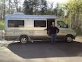
    On a nice sunny day, the drive and park along the busy St. Clair River offers parking nose first, right smack dab on the riverbank. A Type B RV fits perfectly and the view of the fast-moving river is mesmerizing.
    The river is one of the busiest water routes in the Great Lakes, connecting Lake Huron just north of the Blue Water Bridge to Lake St. Clair, a couple dozen miles downstream. Port Huron’s Riverfront is a mecca for big boat watchers. From Lake St. Clair, the big freighters and ocean going vessels make their way into the Detroit River, which in turn connects to Lake Erie. Ship traffic is constant and you will not have to wait long to see one, upbound or downbound.
    But it is also a great fishing river. The fish of choice is walleye and the river serves as a travel corridor for walleye moving between Lake Erie and their spawning grounds in Saginaw Bay, 100 miles up Lake Huron. Fish biologists believe that walleye treat the whole Lake Huron/Erie waters as one system. Walleye can cruise from one body of water to another in days. The St. Clair river is deep and cold which also helps in holding walleye. When outside temps are in the 90′s the St. Clair river will be in the 60′s.
    So if there’s a lull in the freighter traffic, watch the local fishermen.
    In all, Port Huron has 17 waterfront areas containing 102 acres and 3 1/2 miles of water frontage. This includes two public beaches and six parks with picnic facilities. Our favorite is right beneath and just south of the Bluewater Bridge. The city has nine scenic turnout sites containing over 250 parking spaces. They are well-used throughout the year and often illed to capacity most afternoons and evenings during the warmer months, so you may have to do a bit of cruising until one opens up.
    If you can’t get in, make your way north following the signs to Lighthouse Park, right at the mouth of the river. AGain, the parking is fine for a Tye B RV but anything bigger will be hard put to find an adequate space. This park has 900 feet of waterfront and beach and the water is clean for good swimming. But be warned, if you venture out very far, the current is swift as the river starts flowing right from there.
    While at Lighthouse Park, walk a few hundred yards south and tour the historic Fort Gratiot Lighthouse. In 1814, military Fort Gratiot was established to guard the juncture of Lake Huron and the St. Clair River. With a surge of vessel traffic on Lake Huron in the early 1800s, the need for a Light Station to guide vessels into the river became very important. Originally seventy-five feet high, the white painted brick tower was extended to its present height of eighty-two feet in the early 1860s. It’s maintained today by the U.S. Coast Guard and open to climbing (for $7 a person). If you do, no sandals are allowed. So put on some closed toes shoes.
    For food, Freighter’s Restaurant is a great place with great river views. It’s part of the Doubletree Inn hotel complex and is right in the heart of the riverfront action, a few hundred yards south of the bridge.
    One more attraction: The Thomas Edison Depot Museum is right down there, too, pretty much smack dab under the bridge. The famed inventor lived in Pot Huron and worked on a railroad car for his first job form 1859-1863. The museum includes a restored baggage car resting on a short spur of railroad track and has some exhibits about Edison and his early beginnings.
    You can easily spend three our hour hours in Port Huron, stretching your legs, freighter watching, even taking a quick dip in the water up by the lighthouse.
    Heading to the bridge and then over to Canada is a breeze. The route is well marked.
    It costs $3 U.S. to cross. Make sure if they try to charge you more you explain to them that you are in an RV. Commercial vans cost $6 one way.
    You do need a passport to cross into Canada.
    On the way back to the U.S., the bridge fee is $3.50.

    Jennifer watches one of the big lake freighters headed out into Lake Huron.

    A Type B RV can easily park right on the riverbank.

    The walk along the St. Clair River beneath the Blue Water Bridge is a great place to stretch your legs before heading into Canada.
  2. Roadtrekingmike
    The just-concluded Memorial Day weekend in the U.S., a week after Canada’ Victoria Day, means that summer has begun – even though the official start is still a couple of weeks later. And Roadtrekers were out and about over the last weekend so we did another one of our “One Day in the Life of a Roadtrek” photo shoots.
    The rules were simple: Take a picture of your Roadtrek wherever you happened to be at sunset local time. Then email it to me.
    We got a great assortment this year from all over North America.
    Some were on beaches. Some in the mountains. One was in a body shop getting work done. A few were in owner driveways and one was at a special ceremony that launched sky lanterns to honor the 41 Marines of 2nd Battalion, 8th Marines, who gave the ultimate sacrifice during the War on Terrorism.
    Enjoy the video slide show.
    See you out there.

  3. Roadtrekingmike
    I’m about to check off a couple more items from our RV travel bucket list, trips that will take us coast to coast on a summer travel schedule that will have us going from Cape Cod to the Oregon coast, with numerous stops and detours along the way.
    The Cape Cod trip is from June 8-11th as we attend a sold-out Roadtrek International chapter rally of the Family Motorcoach Association that will be held in Brewster, MA. Jennifer and I will meet and visit with over 100 other Roadtrek owners, sharing highlights from our 60,000 miles of Roadtreking travel over the past two years. After a quick look around the Cape, we’ll turn around and get ready to begin the first of our bucket list tours.
    Starting June 12, we’ll be doing a 3,500 mile stretch that has captured my imagination for a long time: The Great Lakes shoreline.
    I have wanted to do this route on a bicycle for a long time. But since I don’t have two to three months to devote to that particular means of travel, I’ll do it in our Roadtrek Etrek, documenting the interesting places and people that are found on the shoreline for this blog and for the Verizon Wireless folks, who have been running many of my reports regularly for the past few months on one of their websites. Verizon likes my on-the-road reports because of the way our Roadtreking life is shared through technology and the ability to report our travel adventures while we are out there, using 4g LTE Internet connectivity and a hist of apps and tech tools that keep us connected. In other words, I’m a geek.
    The Roadtrek Etrek fits right in with all that, of course, what with its solar power and all electric features that let us go days on end off the commercial power grid, totally self-contained and as connected to and surrounded by all the amenities and conveniences we have at home – even though we may be in a remote forest off a tree-canopied two track
    We’ll travel the shoreline as it winds up and around parts of six states, starting in the Lake Erie wetlands near the Pennsylvania/New York border and all the way around, to the Lake Huron “Sunrise Side,” on up to the rock shores of Lake Superior into Northern Michigan, Wisconsin and Minnesota and down along past the spectacular sand dunes along Lake Michigan on through Chicago and up to Milwaukee where we’ll end the tour after a spectacular 4th of July Fireworks display.
    Even with nearly a month to cover it all, we’ll have to hurry. But it’s one of those bucket list things that is made for a Roadtreking adventure. I have a list of places and stories I may check out but, except for the Milwaukee fireworks, Jennifer and I are intentionally keeping our schedule fluid. There will be some things that we will stumble upon and the last thing we want is to be locked into a schedule and have to miss something cool because we “have” to be somewhere else.
    What’s the second bucket list tour?
    This one starts in mid July and will have us retracing large parts of the Lewis and Clark Expedition and the route taken by the Oregon Trail pioneers, starting in Pittsburgh and ending at the mouth of the Columbia River on Oregon’s Pacific Coast. And yes, Pittsburgh was the real starting pont. It is from there, on Aug. 31, 1803, on the Ohio River, that Meriwether Lewis first set off with his Corps of Disovery, joining up with William Clark on the Missisippi River before making their way to St. Louis and the Missouri River – America’s great river to the West.
    There will be a slight detour to the Hill Country of Nebraska. Out there, where the Oregon Trail became America’s first interstate highway, they sell a T-Shirt that says “The Original RV.” It depicts a covered wagon. Almost half a million people made their way along that trail from 1836-1869. There are spots along it today where you can still see the ruts from their wagons.
    Along the Snake River in Nebraska, we’ll attend the Nebraska Star Party July 27-August 1. This area is one of the best places in the Lower 48 to see the night sky with no light pollution. Every year, hundreds of stargazers gather here to marvel at the night sky. Many camp in the middle of a field, boondocking with no lights or electric so their telescopes and cameras have nothing interfering with the starlight. Again, a perfect spot for out Etrek.
    As we rejoin and go back and forth between the Lewis and Clark and the Oregon Trail routes, we’ll report for the blog on the amazing history of what they saw and experienced every day, showing what it is like today and and how their discoveries and pioneering shaped a nation. We’ll stop for several days at the Family Motorcoach Association’s Family Reunion and Motorhome Showcase in Redmond, Ore., Aug. 13 to 16. More than 2,500 motorcoach owners are expected to be in attendance. Jennifer and I will do two seminars there, before heading for the coast, where Lewis and Clark stopped before they turned around and headed back.
    From there, we’ll slowly make our way back to Michigan, visiting Yellowstone National Park and Glacier National Park.
    In all, these two big trips. along with some fun stops along the way, will have us traveling about 8,000 miles though early September.
    Unless we find something else…. which, given our track record, is probably going to happen.
    See why we love this Roadtreking life?

    Lewis and Claks navigated the Ohi, Missisiipi, Missour and Columbia Rivers before heading off by horseback.
  4. Roadtrekingmike
    I’m at the Roadtrek factory in Kitchener, Ontario, Canada for the next two weeks shooting and producing a film to be called The Making of a Roadtrek.
    This is a project I’ve wanted to do for two years and, with the company’s blessings, I am now be documenting the creation of a Roadtrek.
    We began filming Tuesday morning as a brand-new but stripped-down Mercedes Sprinter was driven into the factory for what will be about a 10-day build. The model I am following through the assembly process will become a brand new Roadtrek CS Adventurous.
    Here is what it looked like this morning:

    First it was stripped. Then it was cut.
    Stripping involves removing many of the stock Mercedes trim items that will soon be replaced by Roadtrek’s custom trim, finishes and coverings. The cutting involves just what the name implies ... cutting out the holes and vents in the chassis that will allow for for the conversion of a Sprinter van into an Roadtrek motorhome with its own kitchen, bathroom, bedroom, air conditioning unit and all the appliances and entertainment features that make a van a home.
    The precision and skill of Roadtrek’s technicians are pretty amazing. The two guys who handled the initial stripping and cutting processes have been with the company for 25 years and 19 years respectively. They are truly craftsmen and as I watched them begin turning a stark, empty van into someone’s dream luxury RV, I appreciated anew the quality and experience that goes into each motorhome made in the very busy Kitchener factory.
    Out front of the factory is a “Help Wanted” sign. The RV boom is in full swing and Roadtreks are the top sellers in the Type B motorhome market in North America. Every day, anywhere from seven to nine new motorhomes roll off the assembly line and head out the factory for delivery to customers all across North America. The company refuses to skimp on quality and despite growing demand, each unit is built with precision and care. That attention to detail can’t be rushed.
    I’m using four cameras for this project. In fact, even my drone with a GoPro camera attached was put up in the air for some outdoor video on Day One. I’d really like to fly the drone up inside the factory. That would be some pretty cool video. Not sure, though, whether we can get clearance for that, at least not while everyone’s working. But that would be a great shot.
    I don’t want to scoop myself and give away the contents of the completed film in bits and pieces so I don’t know whether Ill do many more blog posts until the entire film is finished and ready for you to see. Once the CS Adventurous we’re documenting is built, it will take me some time to edit the entire project but I’m hoping it will be ready to see sometime mid-summer.
    Meantime, I will occasionally post various still images on our Facebook Group as the assembly process continues.

    Seven nearly-completed Roadtreks lined up for various quality control and finishing work checks. How many different Roadtrek models can you identify?
  5. Roadtrekingmike
    I love getting reader mail and I do my best to answer them. But lately, as a new RV season gets underway and lots of people are thinking about purchasing a motorhome and more new people are discovering this blog, the questions are somewhat the same. So I thought I’d share here the answer to the one question we get asked the most.
    Q: What would you and your wife do differently in buying an RV now that you've been doing this for a while?
    A: The short answer is … nothing. We now have about 60,000 miles of Roadtreking travel under our tires since March of 2012. We’ve traveled in two Roadtreks, Our first was a 2006 RS Adventurous. The one we currently drive is a 2013 Roadtrek eTrek.
    We did a lot of checking around about what vehicle we wanted and settling on a Roadtrek was very easy. It’s the best-selling Type B in North America. Has been for many years. It has the largest dealer network of Type Bs. It’s resale value is tremendous. It’s quality reputation is stellar. So we knew right away that Roadtrek would be our choice. The rest was easy, too. We wanted a tall interior so we could easily walk around inside and settled on the Sprinter.
    When a used one was about to become available at a local dealer, we put money down sight unseen to have first refusal. We didn’t refuse.
    That said, I do have one regret. I wish we had bought months before. I spent too much time wondering if I could afford it. The truth is, as my friend Yan Seiner says when he faced the same issue, I could not afford to do it. The clock is ticking. I want every moment of the time have left to count.
    Jim Hammill, the Roadtrek President, has a very powerful illustration that brings this home. He says take out a tape measure. Ask yourself how long you think you will live. Say it’s 90. Then ask, how many years will you be healthy enough to enjoy RV traveling. Say the answer to that is 85. Put your finger on the 85 inch mark. Now put another finger on your current age. The length of time between those numbers is how much time you have left. Look at those numbers from one to your current age. They went by pretty fast, didn’t they? Now look at the numbers between 85 and your current age.
    There really is no time to waste.
    We all have a bucket list.
    Jennifer and I are filling ours.
    We just wish we had started earlier because now that we’re Roadtreking, we keep adding to it as we see what an incredible world is out there just waiting to be explored.
  6. Roadtrekingmike
    The RV life offers a lot of choices. From travel trailers, to fifth wheels to motorhomes, there is a vehicle to suit every style. And when it comes to motorhomes, there are essentially three choices – a big Type A (as long as 40+ feet, usually with multiple slides), a Type C (less than 30 but tall and wide, sometimes with slides) and a Type B, often called a camper van and anywhere from 20-25-feet or so in length.
    You may know them as Class A, C and B. The industry thought the term “Class” sounded to elitist so switched to the word Type instead. But either modifier is correct.
    Type Bs are probably the hottest selling segment of the motorized RV market these days.
    But is a Type B right for you? After more than two years of Type B travel and over 50,000 miles climbing mountains, visiting seashores, National Parks and wilderness areas all over North America, I have identified 10 reasons a Type B RV may be right for you.
    1) A Type B RV can go where pretty much where a car can go - A Type B is meant for getting you easily to wherever you want to go, be it a fast food parking lot off the freeway or a remote boondocking spot in the middle of a national forest or BLM lands far off the commercial grid. It is maneuverable and easy to drive yet has all the comforts of home. Which figures, because it is your home.
    2) A Type B RV is for those who like to tour – The bigger motorhomes are just that: Big. Very big. You need to be careful turning corners, changing lanes, going under things and once you get off the interstates, you will get the same looks a slow moving tractor does on a two lane in rural country. A Type B shares the road well with all vehicles, accelerates well, turns easily and doesn’t take up three car lengths of roadway.
    3) A Type B RV actually gets good fuel economy – My first Type B got 22 miles to a gallon. The heavier Roadtrek eTrek I’ve been driving this past year still averages 17-18 mpg. At $4 plus per gallon these days, the fuel savings over the bigger motothomes out there are considerable.
    4) A Type B RV can run errands as a second vehicle at home – I often use the eTrek as a second vehicle. Jennifer has our car. I drive the Roadtrek. Simple as can be.
    5) A Type B RV can stay parked in your driveway in most places – Neighborhood and home owner associations frown on Type A and Type Cs being parked in driveways. There’s not nearly the problem with Type Bs. I don’t have to store my RV in a lot, paying stiff monthly fees. Mine is right in my driveway, ready to take me across town or the country anytime I want.
    6) A Type B RV simplifies the traveling life – It is so easy to go in a Type B. You learn very quickly that you do not need nearly the “stuff” you thought you’d need. You take what you need and are surprised to discover that, other than food, a few changes of clothing and some elementary camping gear, you travel light. And that just feels so right. Free and easy down the road you’ll go. Seriously, I think of my RV every time I hear that Dierks Bentley song. “A pair of boots and a sack of clothes, free and easy down the road I go. Hangin’ memories on the high line poles, free and easy down the road I go.” Oops. Sorry about that.
    7) A Type B RV is for doers, not sitters – Nothing against Type A or Type C RVers but it’s been my experience that Type B owners are folks who don’t like sitting in one place very long. They are hikers, bikers, explorers and they tend to exemplify the slogan on the T-shirts and sweatshirts sold on the Roadtreking Store: Yeah, we have a small house. But we have a big yard. Type B RVers spend a lot of time outdoors.
    8) A Type B RV doesn’t require a lot of set-up and take down – It’s so easy to park in a camping spot. Even if you have to back in. Hooking up takes three minutes, tops. Same with unplugging and leaving. Leveling is seldom a problem. If it is, move a few feet. Try that in a Type A.
    9) A Type B RV is great for day trips and special events – Driving to visit relatives, attending a grandkid’s soccer game or parking along a parade route, there’s nothing like having your own bathroom on board, a fridge and microwave for snacks, or a place to charge computers, smartphones, camera batteries and the like. Because it drives so easy, it’s handy and easy to take non-camping outings.
    10) A Type B RV can serve as a guest bedroom in your driveway – Plug in an extension cord and your Type B can serve as a spare bedroom for guests, giving them – and you – privacy. I know of some Type B owners who use it as a dressing room while attending weddings or as a place to nap cranky kids. Because most Type Bs also have generators or coach batteries to provide power, the Type B is also a great refuge in a storm when the grid supplying your neighborhood is interrupted.
    Okay. Those are my top ten reasons why a Type B RV may be right for you. I’m sure we could come up with ten more reasons. In fact, current Type B owners, please feel free to add to this list under comments.
  7. Roadtrekingmike
    In this episode of our How We Roll in our RV series, we answer reader questions about taking care of our home while we’re off RVing and how we like the Roadtrek eTrek.
    The first question came from Roger Bohnke who asks:
    Q: Maybe a question for your How We Roll series… Mike and Jen, I’ve been wondering how you take care of your house while you two are on all these wonderful long trips? Do you live in a townhouse or condo you can just lock up and walk away from? We want to travel a lot when we retire, but not full time. Though we love our house and yard, I’m considering a move to lessen the hassle factor. I can see yard services, security, etc. adding a big cost to our travel budget. Of course, moving isn’t cheap either!
    Love your site and your wonderful videos. Thanks for all you do! – Roger

    The second question was from Tim Lynch:
    Q: Really enjoy your site and videos. If I’ve got it right, you had an Adventurous before your eTrek. I’m leaning toward an eTrek for myself, but wonder if the added weight of all those batteries affects performance on the road or fuel mileage. Are there any other differences, pro or con, that you’ve seen between the two?
    The name of the home security system that Jennifer mentions in this episode is SimpliSafe. I did a video report about it a few months back. Here’s a link to that story: Protecting Your Sticks-and-Bricks House While You're RVing.
    Meanwhile, if you have a question you’d like Jennifer and me to answer in an upcoming episode of this regular series, just drop us a note at openmike@fmca.com.
  8. Roadtrekingmike
    I’ve spent much of the past two months using my spare time to study photography, though online courses, books and some classroom work. I also, gulp, bought a professional grade camera and have been learning its ins and out, too. All this in preparation for our RV visits to various National Parks across the country.
    This year, I’m going to concentrate even more out there on photography, spurred on by the annual photo contest sponsored by the National Park Foundation.
    The photo accompanying this post was the just-announced winner of the 2013 contest, which brought in more than 20,000 entries. It’s from Courtney Kotewa and it is of the Pictured Rocks National Lakeshore in Michigan’s Upper Peninsula, which I will visit in mid June. She lives in southern Michugan took the photo last summer during a family vacation. Second place is also from lake Superior. It is of the ice caves that formed along the Apostle Islands National Lakeshore this past winter and was taken by Michael DeWitt. He’s is from Ashland, WI, not far from the Apostle Islands. We plan to visit the Apostle Island National Lakeshore in late June
    After that we head west. To Glacier. Yellowstone. The Canyonlands and more. In the fall, the Great Smoky Mountains National park is on the planned trip list. So is another visit to Everglades National Park.
    I’ve been browsing this year’s winners. I can’t wait to get out there.
    A complete list of 2013 winners and their photos are available for viewing at www.nationalparks.org/photowinners.
    The National Park Foundation, the official charity of America’s national parks, is the main sponsor of the annual contest, which encourages amateur photographers to explore the nation’s federal lands and share their experiences by capturing and submitting their favorite shots. The winning picture may also be featured on the annual Federal Recreational Lands Pass.
    The 2014 contest is well under way. Photos must be taken from Jan. 1, 2014 through Dec. 31, 2014.
    The grand prize for the winning image is $10,000, followed by $5,000 and $3,000 for second and third place, in addition to outdoor gear provided by Celestron, hotel packages courtesy of Historic Hotels of America, and an annual Federal Recreational Lands Pass. There are also prizes for fan favorites and the following six category winners:
    Adventure and Outdoor Recreation
    Historical and Cultural
    Scenic, Seasons, and Landscapes
    Let’s Move Outside
    Wildlife
    Night Skies (a new category for the 2014 contest)

    Share the Experience is the official photo contest of America’s national parks and federal recreation lands. The 2014 contest is sponsored by the National Park Foundation, ACTIVE Network, and Celestron in partnership with the National Park Service, the Bureau of Land Management, the Bureau of Reclamation, the U.S. Fish and Wildlife Service, the U.S. Forest Service, and Recreation.gov. The contest entries showcase the more than 500 million acres of federal lands and draws entries from all across the United States.
    Bookmark this post. To enter a photo for this year’s contest, go to: http://www.sharetheexperience.org/
    See you out there …
  9. Roadtrekingmike
    Jennifer and I love watching things grow, planting them, tending to them and then – with our vegetable garden – picking them when they are fresh and ripe and enjoying them.
    We’ve planted a garden for many ears but the last two years, because of our travel schedule, we’ve returned home from RV trips to find it mostly shriveled up from lack of water or, unpicked, gone to seed.
    Nevertheless, there we were this week, getting the vegetable beds ready again, hoeing, weeding, improving the soil and planning it out.
    The peas and the new strawberries will be in by the weekend. The rest, a couple of weeks yet when the threat of frost at night has gone away.
    We’ll do it again this year, despite a travel schedule that will have us gone all but a few scattered days pretty much from June through September.
    There is something that is just plain right about planting and tending a garden. It is deeply satisfying, relaxing, good for the soul.
    But this year, we will enlist some friends and neighbors to water and tend to our garden while we’re gone.
    Starting in a few weeks, we have trips planned that will take us to the east coast, all all around the Great Lakes in the Midwest and then a big trip to the mountains and national parks of the west and the Northwest. The veggies I plant over the next couple weeks will be ready for harvesting while we’re still out on the road.
    But this year, we’ll ask friends and neighbors to harvest it as it ripens. Hopefully , we’ll find some ready for picking on our visits home between trips.
    I’ve seen RVers who travel with small pots of staked tomatoes.
    With the limited space in a Type B, I’m not sure how feasible that is.
    How abut you? Have you traveled with fresh and container-growing veggies? f so, how?

    This is my garden. We grow in raised beds behind a fence that keeps the deer out. I’ve been getting the dirt ready for planting this week.

    This is last year’s garden, just before we took off on a long trip to Colorado. Most of it was lost because of neglect.
  10. Roadtrekingmike
    If you like peace and quiet and lots of elbow room where you camp, you will not want to be on RV Row at the Kentucky Derby.
    But if a non-stop party is what you’re looking for, then the private parking lot right next to Churchill Downs is where you’ll want to be Kentucky Derby week.
    The parking lot is owned by Fred Stair and he rents RV spaces out for the Thursday-Sunday Derby weekend as the Captain’s Derby Parking, even providing water, a dump station and limited electricity. Cost is $650 for the the long weekend for units up to 28-feet long, $750 for bigger RVs with extra charges for slide outs and awnings. Fred parks them tight together, so tight, you may have to walk sideways if you are cutting between units.
    You can see in the accompanying video what it’s like.

    Jennifer and I were on assignment for Verizon Wireless, covering the Derby itself and we kept hearing people talking about free beer and the party going in the parking lot adjacent to Churchill Grounds. When we heard it was called RV Row, we had to check it out.
    We met a guy from Chicago who was celebrating his wife’s 50th anniversary on RV Row. He brought his own coach and rented four trailers. In all, he had 23 guests on RV Row.
    We met the Milwaukee guys who ran the Home Stretch Bar, a fixture on RV Row for more than 40 years. “Our Dad’s started this a generation ago,” said Joel Papp, one of the organizers. They set up a bar and serve up free drinks pretty much all day and all night from in front of their RV, from the Thursday before the Derby right on till when the RVs break camp and head home on Sunday.rvrow2
    We shot a bunch of pictures and did the video and said goodbye. Our Roadtrek was parked across town, 12 miles away, in a very quiet hotel parking lot.
    RV Row was a fun place to visit. I just wouldn’t want to live there.
  11. Roadtrekingmike
    Question: What’s the difference between a flashlight and an illumination tool?
    Answer: About $70. Or more.
    And some pretty powerful lights.
    One piece of gear all RVers have is a flashlight. Usually several. I most often relay on a small headlamp that I picked up at REI. It lets me have hands-free use when I arrive at a campsite after dark and need some illumination to set up.
    But we also have a couple of regular flashlights in our motorhome.
    They are nothing like the “illumination tools” made by a company called XtremeBeam, which offers a series of very high-tech, ah, flashlights, typically used by police department and military SWAT and tactical teams. In fact, most of the lights can be mounted to firearms.
    The company sent me three of their illumination tools to test out, ranging in price from $70 to $150 or so.
    I’m impressed. You can see in the video how well they do lighting up a forest and creek in the middle of the night.

    All three have LED lights and use very long-lasting lithium batteries.
    Here’s the three I tested in the video:
    The ExtremeBeam XT8 Proranger flashlight. The company claims it has an 850 foot range. Maybe, but my test seemed to show it fading out a bit less than that. It’s hard to gauge from the video but this little light was just okay, in my view, surely not something I’d spend $70 on.
    The TAC-24 – The claim for this one is a 1,200 foot range and I have no problem believing that. The price is about $100 and this has several different modes, including strobe and an setting that will automatically send an SOS. Seriously. Push the mode button til it cycles through the other options and it starts sending out three shorts, three longs and three more shorts. Over and over again. Automatically, while you’re doing other things like trying to survive or fighting off angry bears or whatever.
    The M1000 Fusion – Whoa, baby! This big light takes four lithium batteries and can illuminate an entire block! It weighs a pound or so. It has a claimed 2,000 foot range and, again, my test seemed to validate that. I could have used it as a searchlight outside a movie premiere. It looks like those lights in the old prison escape movies. Or maybe a lighthouse. Whatever. Trust me, it is very, very dark-piercingly bright. Price is $149.

    My take?
    Police and SWAT teams may love these lights but I think they are a bit of overkill – pun intended – for the average RVer.
    The TAC-24 was my favorite. It’s small enough to put in a photo bag or day pack and is perfect if darkness falls while hiking or doing photo work far from camp. If something happened out there in the wilds, those strobe and SOS features would be very handy, especially with those long lasting batteries. I’d buy this one.
    And the M1000 blew me away. It is big and very expensive. Because of that, it probably wouldn’t be in my tool kit. But back in the boondocks, all that illumination would sure show what those weird noises are that we hear around the campfire.
    My best and most used flashlight remains my old faithful REI headlamp.
    But next to it, the TAC-24 is now going to be standard gear aboard the Roadtrek.

  12. Roadtrekingmike
    Colorado has so many great spots to visit but one you just do not want to miss is the Garden of the Gods Park near Colorado Springs. We’ve been there twice, once in the winter and once in the summer. Both trips were excellent and made us determined to come back again and again.
    The red-colored sandstone formations tower as high as 300 feet and walking trails lead right up to them.
    The Garden of the Gods Park is a registered National Natural Landmark that has been exciting tourists since the mid-1850′s. Before that, the Utes oral traditions tell of their creation at the Garden of the Gods and petroglyphs have been found from the 15th century.
    The area got it’s name in August of 1859 when two surveyors started out from Denver. While exploring nearby locations, they came upon a beautiful area of sandstone formations. M. S. Beach, who related this incident, suggested that it would be a “capital place for a beer garden” when the country grew up. His companion, Rufus Cable, a “young and poetic man”, exclaimed, “Beer Garden! Why it is a fit place for the Gods to assemble. We will call it the Garden of the Gods.” It has been so called ever since.
    At least that’s how the official story goes on the Garden of the Gods website.
    We stayed at the nearby Cheyenne Mountain State Park, one of the nicest state parks we’ve stayed at anywhere. Located just south of Colorado Springs, the park has 51 sites amidst 1,680 acres. It is located right beneath the eastern flank of Cheyenne Mountain, and border the plains of Colorado and offers view that are a stunning transition from plains to peaks.
    The land around the park is in remarkable natural condition and diverse wildlife viewing opportunities abound due to the property’s relatively undisturbed location. Because the park just opened in 2000, everything is nice and new.
    The Garden of the Gods is about a 25 minute drive from the park and can be seen in half a day. We drove up nearby Pikes Peak in the morning and toured the Garden of the God’s n the afternoon. Next time we visit, I plan to spend the day and use the bike trails that circle the park.
    What’s so amazing about the place is that the towering deep-red, pink, and white sandstone and limestone formations were originally deposited horizontally, but have now been tilted vertically and faulted by the immense mountain building forces caused by the uplift of the Rocky Mountains and, specifically, Pikes Peak nearby. Geologists have found evidence of many different geologic features in the rocks, deposits of ancient seas, the eroded remains of ancestral mountain ranges, sandy beaches, and great sand dune fields. Retired biology professor Richard Beidleman notes that the park is “the most striking contrast between plains and mountains in North America” with respect to biology, geology, climate, and scenery. Dinosaur bones have been found throughout the park.
    The park is amazingly accessible. We had no problem parking our Roadtrek eTrek in the many parking lots that ring the park. It is open to hiking, technical rock climbing, road and mountain biking and horseback riding. It attracts more than two million visitors a year and is the city’s most visited park.
    There are more than 15 miles of trails with a 1.5 mile trail running through the heart of the park that is paved and wheelchair accessible. Dogs on leashes are welcome.
    We walked the paved path and gazed upwards. We saw and photographed mule deer, first seen by Tai who sniffed them out and finally spotted them gazing in the shrubbery that abuts some of the larger formations. His barking drew a crowd of camera toting tourists but the deer obliged us all as we snapped away.
    If you go, make sure you visit the Garden of the Gods Visitor and Nature Center, at 1805 N. 30th Street. It and offers a great view view of the park from an outdoor terrace. The center offers all sorts of educational exhibits, staffed by Parks, Recreation and Culture employees of the City of Colorado Springs. A short movie, How Did Those Red Rocks Get There? runs every 20 minutes. A portion of the proceeds from the center’s privately owned store and cafe support the non-profit Garden of the Gods Foundation; the money is used for maintenance and improvements to the park.
    More pics:

    You can walk right up to the formations.

    The park is simply stunning.

    My son, Jeff, near his borrowed SS Agile, walking his dog, Sequoia, at Cheyenne Mountain State Park

    Our camping spot at the Cheyenne Mountain State Park. We towed that travel trailer out there with our Roadtrek eTrek for my daughter and her family.

    They call this formation “The Kissing Camels.” Can you see why?
  13. Roadtrekingmike
    I’m often asked about the favorite things we’ve done in our Roadtrek eTrek. At the top of my list is mountain climbing.
    We used it to drive to the top of Pikes Peak, some 14,114 feet high.
    It’s a long haul up and when we entered the road that would take us to the top off Highway 24 west of Colorado Springs, we had to have the ranger help us drive around a barrier meant to keep larger vehicles from attempting the climb. At first, they tried to wave us off. Then they saw that our Roadtrek RV was on the Mercedes Sprinter chassis.
    “NThe Pikes Peak Highway is 19 miles long, a 38 mile round trip. The trip up works the engine hard. It burns fuel like crazy. Coming down, not so much. But if you decide to go, make sure you have enough fuel.
    On previous visits, I twice tried to get to the summit. The first time was during a business trip a couple years ago in a rented Kia. On a cold January day we made it to 11 and a half miles up. But a sudden snowstorm shut down the rest of the drive. We white-knuckled the way back back down behind a snow plow. By the time we reached the bottom the entire road was closed.
    On another visit, we boarded the cog railroad that runs to the summit. It, too, had to turn back because of blowing snow and heavy winds.
    So on this trip with the Roadtrek, last August, we we optimistic. At least it wasn’t snowing. But it could have. Snow falls at the higher elevation all times of the year.
    "No problem,” the ranger said, motioning us around. “You can handle it in this. Just watch the brakes on the way down. They will heat up.”
    It was 87 degrees when we set off. By the time we reached the summit, it was 46 degrees.
    It took about an hour and a half to drive to the summit. There are lots of twists and turns and we frequently stopped at some of the pulloffs for photos as we climbed through the various regions, from the rock strewn glacial moraines at the bottom on through the alpine and sub alpine areas. We found nothing particularly scary about the drive up. But we were too bust oohing and ahhing at the incredible scenery. The Roadtrek handled the constant climbing with plenty of power.
    At Glen Cove, between mile 11 and 12, there is a place that sells souvenirs and has a limited-service restaurant. But after that, it’s almost straight up as you pass the tree line where conditions make it impossible for any upright plant to grow. At Mile Marker 16 you’ll pass Devil’s Playground, so named because of the way lightning jumps from rock to rock up there during storms.
    The summit itself is basically a parking lot. There’s a small weather station up there, an observation deck and, of course, a souvenir shop.
    We were the only RV up there at the time, though I’ve had other RVing friends say they drove their drove their Class Bs up there, too. I suppose a C might also make it. But I think it would be a tough haul for anything bigger.
    Jennifer and I brought our son, Jeff, and his wife, Aimee, up to the summit in our Roadtrek, as well as our dog, Tai, and their dog, Sequoia.
    We wandered around for a bit, a little dizzy at times from the altitude. The dogs seemed refreshed in the shin, cool air. We shivered in the wind and, took the obligatory “we were here” photos and started back down.
    The drive down was much more challenging. The hard part was not letting the momentum build up too much speed. I downshifted pretty much the whole way down to use the engine to help me slow, but when we stopped for the mandatory brake check at Glen Cove, we had to pull over and wait for a half hour or so for the brakes to cool down. We weren’t alone. About every other automobile and every truck had to pull over, too, many of them so hot they were smoking.
    There’s no way to avoid using the brakes as you head down. The secret to keep them from burning up, we found, is to apply sharp and firm pressure to reduce speed and then release the brakes, instead of a riding them with a steady pressure. Engine downshifting is the best way to go, just watch the RPMs to keep it from redlining.
    I used the time to take Tai for a walk. Just down a service road off the Glen Cove parking lot, we jumped a couple of big mule deer. Tai felt pretty smug as he watched them run off.
    Finally, as we were heading down the mountain and rounding those hairpin turns with the awesome scenery, I stuck the GoPro out the window and shot a few seconds of video the drive down. Check this clip out:

    Pretty awesome, huh?
    Pikes Peak. Been there done that. In our RV. Total time from start to finish and our exploration at the summit was about three and a half hours.
    It’s one of our favorite memories.
    Next time, I’m going to stop and explore more on both the ascent and the descent. I’ll make an entire day of it.

    At the summit of Pikes Peak, 14,114 feet

    Spectacular views abound

    You actually look down on other mountains from the Pikes Peak summit.

    It was in the upper 80s down at the start of the climb but in the 40s up top. Our Roadtrek hauled four adults and two big dogs with ease.
  14. Roadtrekingmike
    If you are a regular reader, you know Jennifer and I love to RV across Michigan’s pristine Upper Peninsula – the UP – where big towns simply aren’t, and the scenery is jaw-dropping gorgeous with lots of forests, lakes and streams and, of course, the Big Lake, Superior, which some say is the coldest, deepest fresh water lake in the world.
    Superior borders the UP to the north. The south coast of the UP is bordered by Lakes Michigan and Huron.
    We visit the every time we can, in all seasons. If you’ve never been or would like to spend more time there, here’s my suggestion for the RV Tour of the UP.
    I suggest to budget 10 days for this.
    And the first thing I suggest is that you try to avoid black fly season which usually starts in mid June and runs through mid-July. The black flies are most prevalent along the lake Superior shoreline but you’ll find them, and giant mosquitoes, most active during that time.
    Just to show you how bad they are, check this video I did last summer.

    Don’t believe it? Then check this one from the year before.

    But don’t let them deter you. Just be prepared. Bring long pants, jackets and sweatshirts, too, as even in summer, it can get chilly up there.
    Getting there
    From the west, find US 2 from Wisconsin and just keep driving east.
    From the south, Cross from Michigan’s Lower Peninsula on I-75 and the five-mile long Mackinaw Bridge.
    Here are our five top suggestions about the places you should visit.
    1) The Soo Locks
    I’d start at the very northern end of I-75 in Sault Ste Marie, Michigan and a visit to the famed Soo Locks (Sault is pronounced “Soo”). The locks are a set of parallel locks which enable ships to travel between Lake Superior and the Lower Great Lakes. Here you will see a parade of giant lake freighters, barges, tugboats and more traverse the 21-foot drop between Lake Superior and Lake Huron every day. The Soo Locks are the busiest locks in the world, and include the largest lock in the Western Hemisphere, completed in 1968.
    The two active Locks, the MacArthur and the Poe, handle an average of 10,000 vessel passages per year, which means visitors are almost certain to get a glimpse of one or more of the many ships that ply the Great Lakes. From viewing stands situated at the Lock’s edge, enjoy an up-close-and-personal glimpse of life aboard freshwater and ocean-going freighters, some of which can carry as much as 72,000 tons of cargo in a single pass.
    There is something really majestic about spending a few hours watching the boats make their way through the locks. You can get so close to them you can even exchange greetings with the crewmen who toil on the big freighters.
    The best place to stay if you want to watch the freighters is the city’s Aune-Osborn Campground, which lies along 20 acres of waterfront property on the lower St. Mary’s River. The western end of the park houses the camp sites. The eastern end of the park is undeveloped and is used for special events and sightseeing on the St. Mary’s River. The campground features 100 water and electric sites. It opens in mid-May. Some sites are right on the river bank but most sites offer views of the maritime traffic headed to or from the locks. This park fills up most summer nights.
    A half hour west is Brimley State Park, a modern 237 site campground with electric on site and a dump station for taking on water. Located at the Southern end of Whitefish Bay, it also has a swimming beach.
    2) Pictured Rocks National Lakeshore
    Move west along the lake Superior Shoreline to the tiny little lakefront town of Grand Marais and the heart of the Pictured Rocks National Lakeshore.
    Here’s a video.

    Pictured Rocks National Lakeshore is a U.S. National Lakeshore on the shore of Lake Superior in the Upper Peninsula of Michigan, United States. It extends for 42 miles along the Superior shore and covers 73,236 acres.
    Unlike any other place on Lake Superior, Pictured Rocks offers the opportunity to explore miles of pristine beaches, hike over 100 miles of trails, and experience the serenity of the northern hardwood forest. The best way to see thee cliffs is by kayak, though the shoreline hiking trails offer very impressive views, too.
    Sandstone cliffs, beaches, sand dunes, waterfalls, lakes and forest will treat your eyes as you hike, paddle, camp and explore. From Munising, at the western end of the park, there are glass bottomed boat excursions that are worth taking. They usually start operation for the summer around Memorial Day.
    There are National Forest campgrounds, state forest campgrounds all along the shoreline. In the tiny harbor town of Grand Marais is the Woodland Park Campground, right along the shore. It offers great beach walking and agate hunting. The campground does not take reserrvations.
    Our favorite camping spots, though, are the federal campgrounds on the lakeshore. The lakeshore’s federal campgrounds are rustic and do not have electric, telephone, water, or sewer hookups. Typically there is no cell phone reception. In our Roadtrek eTrek with solar, that is no problem. The campgrounds have generator-free zones.
    First choice for us is always the Twelvemile Beach Campground, about 12 miles west of Grand Marais off Alger County Road H-58. The campground’s 37 sites are located on a sandy bluff above Lake Superior’s Twelvemile Beach. The entrance road winds through a picturesque stand of white birch. Twelvemile Beach Campground also features a 2.0 mile self-guiding interpretive trail. This place fills up most summer nights so arrive mid morning.
    We also like the two Hurricane River campgrounds, the Upper and Lower. They are located off Alger County road H-58 three miles east of Twelvemile Beach campground where the Hurricane River flows into Lake Superior. Eleven campsites are available in the lower campground loop, and ten in the upper loop. A level 1.5 mile walk on the North Country Trail east from the lower campground leads past shipwreck remnants to the historic Au Sable Light Station.
    If you need hookups, try Muskallonge Lake State Park. located 15 miles east of Grand Marais on H-58; 28 miles northwest of Newberry in Luce County. The 217-acre park is situated between the shores of Lake Superior and Muskallonge Lake and the area is well known for its forests, lakes, and streams. The park has 170 modern campsites that feature electricity and two shower and toilet buildings.
    3) Copper Harbor
    Copper Harbor is located at the tip of the Keweenaw Peninsula hat just up from the western end of the UP. Hold your left hand sideways with your thumb pointing up. That’s the Keweenaw. You can’t go any further north without falling in Lake Superior. In fact, Lake Superior borders the little town of Copper Harbor on three sides. A mountain, Brockway Mountain, hems it in from the South. It is so remote that you can’t even get cell phone coverage in town. There’s one way in, US 41, which dead ends about two miles out of town.
    It is one of the best spots we’ve found to take our RV anywhere in North America. Copper Harbor, with a year-round population of 90, prides itself on being far away, But what it lacks in big city amenities, it more than makes up for in outdoors fun.
    Start out at the Historic Fort Wilkins State Park, tucked along the shoreline of Lake Fannie Hooe, a long inland lake loaded with trout that is just across US 41 from the pounding surf of Lake Superior. There are two loops to the park, the west unit with paved pads for big rigs, and the east unit with flat but grassy spots a half mile away. Separating the two campgrounds is Fort Wilkins, a wonderfully restored 1844 military outpost.
    There is, across from the Fort a quarter mile out into the Big Lake, a lighthouse, first constructed in 1846. It, too has been restored and tours are available all day. You need to board a boat in Copper Harbor for a short ride to the lighthouse.
    he town has become a mountain biking mecca, with world class trails abounding in the hilly forests that surround the town. We found mountain bikers gathered from across the country. Many are very hardcore and the trails are technical. But there are also easy rides and a great place to rent bikes right downtown. At the end of the day, the bikers all congregate at the Brickside Brewery, a very friendly microbrewry that hand crafts artisan brews.
    Copper Harbor is also a center for kite surfing. We watched a half dozen wetsuit clad kite surfers scoot across the frigid waters and always roiling waves of the lake.
    Also in town and well worth a hike is the Estivant Pines, a 500 acre stand of virgin white pines. Michigan, in the mid to late 1800′s was the land of white pines and the entire state was practically clear cut by thousands of rough and tumble lumberjacks. The white pine, which grows 150 feet tall, were used for sailing masts and its lumber built many a frontier town as the nation expanded west.
    4) Porcupine Mountains
    The Porcupine Mountains, or Porkies, as the locals call them, are a group of small mountains spanning the northwestern Upper Peninsula of Michigan in Ontonagon and Gogebic counties, near the shore of Lake Superior.
    The Porcupine Mountain Wilderness State Park consists of over 60,000 acres and s contain the largest tract of old-growth hardwood forests west of the Adirondacks and is home to black bear, deer, wolves, river otters and even moose, as well as rare woodland plants that depend on the old-growth forest habitat that abounds here.
    Visiting the virgin forests, free-flowing rivers and undisturbed beaches of the Porcupine Mountains Wilderness is like taking a step back in time. There are great hiking and mountain bike trails here and hundreds of waterfalls, secluded lakes, wild rivers and streams.
    Our favorite spot is the Presque Isle River Campground, on the western end of the park.
    It has 50 sites and about half are generator free. This is quiet. You can sometimes hear wolves howl at night and most of your neighbors are in tents, campers or small RVs.
    If you must have power, then try the Union Bay Campground, located at the opposite end of the park. Union Bay campground is the largest campground in Porcupine Mountains Wilderness State Park. It offers modern bathrooms and showers. The campground borders a rocky and scenic section of Lake Superior in the eastern portion of the park on the way to Lake of the Clouds on county road 107.
    But don’t expect a wilderness experience at Union Bay. It is a busy, noisy and crowded state park. This where where the Big Class A RVs seem to go.
    5) Tahquamenon Falls
    At 50,000 acres, the Tahquamenn Falls State Park stretches for over 13 miles and is centered around the Tahquamenon River and its waterfalls. The Upper Falls, one of the largest waterfalls east of the Mississippi has a drop of nearly 50 feet, more than 200 feet across and a water flow of more than 50,000 gallons per second. Four miles downstream is the Lower Falls, a series of five smaller falls cascading around an island. Although not as dramatic as the Upper Falls, they are equally magnificent. The falls can be viewed from the river bank or from the island, which can be reached by rowboat rented from a park concession. The island walk affords a view of the falls in the south channel.
    This is the land of Longfellow’s Hiawatha – “by the rushing Tahquamenaw” Hiawatha built his canoe. Long before the white man set eyes on the river, the abundance of fish in its waters and animals along its shores attracted the Ojibwa Indians, who camped, farmed, fished and trapped along its banks. In the late 1800′s came the lumber barons and the river carried their logs by the millions to the mills. Lumberjacks, who harvested the tall timber, were among the first permanent white settlers in the area.
    Rising from springs north of McMillan, the Tahquamenon River drains the watershed of an area of more than 790 square miles. From its source, it meanders 94 miles before emptying into Whitefish Bay. The amber color of the water is caused by tannins leached from the Cedar, Spruce and Hemlock in the swamps drained by the river. The extremely soft water churned by the action of the falls causes the large amounts of foam, which has been the trademark of the Tahquamenon since the days of the voyager.
    There are two excellent campgrounds here, one at the Lower Falls, and one at the mouth of the Tahquamenon River where it empties onto Lake Superior, east of the tiny UP town of Paradise. The Lower Falls campground has two loops with 90 spots in each. The Rivermouth campground has 36 spots. Electricity s available and flush toilets in the restrooms.
    Our favorite time to camp here is winter. The state plows out a good number of sites and although the water is out in the winter, the solitude and beauty make it absolutely spectacular.
    There is snowshowing and cross country skiing in the winter and a four mile trail runs from the Upper to the Lower falls.
    This park gets crowded on the summer. The state does take reservations, without which, you’l be lucky to get in during peak time on weekends and holidays.
    So much more
    There is so much more to see and experience by RV in the UP.
    The Les Cheneaux Islands. The Lake Michigan shoreline. The Seney National Wildlife Area. Whitefish Point. The Huron Mountains.
    But I promised to share my top five suggestions. Maybe I’ll do a follow up report later on my next five.
    See why I suggest 10 days as a minimum time for your visit?
  15. Roadtrekingmike
    We’ve shared this on our Facebook group but thanks to a reader’s suggestion, I thought I’d better post it here on the Roadtreking blog as well: Roadtrek has made it easy for owners of its various models to keep up with the best operating practices and learn exactly how their motorhomes work by putting new revised editions of its owners manual online.
    They can be accessed directly from the company website at http://www.roadtrek.com/manuals.aspx.
    The manuals, in convenient .pdf form for easy printing and reading, go all the way back to 1987.
    I’ve been sending lots of readers to the download site in recent days, many of them folks who are shopping for their first Roadtrek. Others who have owned a Roadtrek for years, have misplaced their original printed manual or worn it out.
    To download them directly to your computer, just right click on the file name for your model.
    You will especially appreciate all the new photos, which offer great how-to information on how the features on various models work.
    There are detailed notes on winterizing, de-winterizing, how to use the macerator, how the batteries and inverter work and what are the best operating positions for the various functions.
    Check it out.
  16. Roadtrekingmike
    It’s easy to see why American Indians and the early settlers called the area of southwestern South Dakota the Badlands.
    They are dry, unbearably hot in the summer, rugged, isolated and - in the days before modern transportation – extremely difficult to navigate.
    But while it may be an inhospitable place to live, these days the Badlands make for a very good visit by RV.
    Jennifer and I try to spend time here each year. You could say we’ve gotten hooked on the Badlands.
    The Badlands National Park protects 242,756 acres of sharply eroded buttes, pinnacles, and spires blended with the largest undisturbed mixed grass prairie in the United States.
    There is a rugged beauty about the place like none other we have seen anywhere in North America.
    You will see bison, bighorn sheep and prairie dogs throughout the park, sometimes far off, sometimes surprisngly close. On the down side, you need to be snake aware out here. Prairie rattlesnakes abound.
    The Badlands were formed by the geologic processes of deposition and erosion. Deposition of sediments began 69 million years ago when an ancient sea stretched across what is now the Great Plains. After the sea retreated, successive land environments, including rivers and flood plains, continued to deposit sediments. Although the major period of deposition ended 28 million years ago, significant erosion of the Badlands did not begin until a mere half a million years ago. Erosion continues to carve the Badlands buttes today. Eventually, the Badlands will completely erode away.
    During the Age of Dinosaurs, a warm, shallow sea covered the Great Plains, including what is now Badlands. As a result, the Badlands contain one of the world’s richest fossil beds.
    Since dinosaurs were land creatures, no fossils of these animals have been found in the park. Giant marine lizards called mosasaurs swam in the ancient sea, along with sea turtles and fish.
    The park is open year round, though we seem to always visit in the summer. Temperatures can easily hit 100 degrees during the day. So we plan our hiking and bike riding in the early morning.
    The badlands are a photographer’s dream location.
    The craggy spires and wide open spaces seem to look different with every glance, every time the sun goes behind a cloud, and as the day draws to an end. Sunrises and sunsets here are spectacular.
    Three days and two nights are the minimum time to spend if you want to see most of the park. We always budget a visit of that long as we’re either heading west towards Yellowstone, or back home towards Michigan.
    Getting to the Badlands is easy. Interstate 90 (I-90) is located directly north of the park and provides access to the Hwy 240 Badlands Loop Road. For those traveling west on I-90, take Exit 131 (Interior) and follow the signs directing vehicles south approximately three miles to the Northeast Entrance. For those traveling east on I-90, take Exit 110 at Wall, South Dakota. Follow signs directing vehicles south approximately seven miles to the Pinnacles Entrance.
    State Highway 44 provides an alternate, scenic access to the park and intersects Highway 377 in the town of Interior. Follow 377 two miles north to the Interior Entrance.
    When we leave the Badlands, we prefer driving the two lanes of Highway 44 west to the Black Hills area instead of heading back to I-90.
    There are three campgrounds to choose from. Two are operated by the National Park Service - Cedar Pass Campground and Sage Creek Campground.
    Cedar Pass is located near the Ben Reifel Visitor Center and has 96 level sites with scenic views of the badlands formations. Camping fees are $18 per night per campsite, or $30 per night for campsites with electrical hook-ups. A dump station is available for a $1.00 per use fee. Cold running water, flush toilets, and covered picnic tables are available. In the summer, it’s often filled.
    Sage Creek is a primitive campground. You are apt to have bison wandering about the campground. It’s located on the west side of the park’s North Unit, near the Badlands Wilderness Area. Access is located off of the Sage Creek Rim Road, an unpaved road that may temporarily close after winter storms and spring rains. The road provides limited turnarounds for large recreational vehicles, but Type B and C motorhomes have no problems. Camping here is free. There is no electricity or water, but there are pit toilets and covered picnic tables. This campground rarely fills up.
    The third area campground is the White River KOA, located about four miles outside of the park. This is our favorite spot to stay in the Badlands. It is located in a quiet, rural area with large shade trees beside the White River. There’s a great dirt road right across the street from the campground that is perfect for bike rides Believe me, the shade of the campground is well appreciated, as is the swimming pool.
    The Badlands: Put it on your must visit list.
    And even if you have been there before, I bet, like Jennifer and me, you, too, want to keep returning.
    Right?
  17. Roadtrekingmike
    Roadtrekers love to take photos. And while our styles, skills and the things we like to photograph may vary, one thing I bet all of us like to get are images of a sunset.
    I’ve used these awkward days of spring before the warm weather travel season really gets under way to organize the thousands of photos I’ve taken over the past two years and 50,000 miles of roadtteking across North America.
    The photos could be better. But even my ineptitude is smoothed over by the awesome beauty of a sunset, whether on a beach in the mountains or a forest.
    Seeing them all together like this reminds me of the sound of waves on a rocky beach, the smell of cedar and pine in the northwoods, the chirping of birds and the sound of cicadas as dusk falls. I can almost breathe in the fresh air. I feel my neck muscles relax and all the tension of another busy day let go.
    I look forward to campfires and starry skies, early morning coffee outside the Roadtrek on a dew-covered picnic table, long walks amidst wildflowers and aspen, gazing at the majesty of the snow capped mountains and watching my dog, Tai, straining to hear sounds deep in the woods, his nose sampling scents I can’t begin to comprehend.
    It’s time to hit the road.
    Ahhhhh.
    Here’s a brief slideshow that hopefully will get you as excited as I am to once again get out there.

  18. Roadtrekingmike
    One of the great joys of traveling North America in an RV is the way it connects you to history and the people and places that have shaped us. So it was for us when we came to a historic site along the famed Natchez Trace where American explorer, soldier, and public administrator Meriwether Lewis – best known for his role as the leader of the Lewis and Clark Expedition with William Clark – met his death on October 11, 1809 under highly suspicious circumstances.
    He was 35 years old at the time, and his death by two gunshots remains one of the greatest unsolved mysteries of all time. Was it suicide or murder?
    The Natchez Trace Parkway is administered by the National Park Service and it has a Meriwether Lewis Memorial on the site where the famed explorer died.
    The Trace itself, meanwhile, is a meandering two-lane 444-mile drive through exceptional scenery and 10,000 years of North American history. It’s worth an RV trip all by itself. Give yourself a week to fully explore. Stretching from Natchez, MS to just south of Nashville Tenn., it was an interstate before there were interstates, used by American Indians, settlers, bandits, fur traders and armies. The Old Trace played an important role in American history.
    Today, visitors can enjoy not only a scenic drive but also hiking, biking, horseback riding, and lots of camping spots all along the Trace.
    There are lots of scenic pullouts but the one that captivated us the most was the Meriwether Lewis site. You’ll find it just off the Trace Parkway, south of Nashville, southwest of Columbia and east of Hohenwald, Tenn.
    The memorial site occupies a 900-acre tract that contains Lewis’ grave, a monument that the State of Tennessee erected in 1848, a “reasonable facsimile” of the Grinder’s Stand tavern/inn that the CCC built in the 1930s, and other visitor use facilities, including restrooms, a picnic area, hiking trails, and a beautifully wooded no-fee campground with 31 no-hookup sites.
    I’d suggest overnighting there. You can still hike parts of the old Trace and easily imagine what it was like back when Lewis met his fate there.
    That facsimile of the tavern now contains a great interpretive center that lets you review the highlights of the famed explorer’s life, look at photos and review eyewitness statements and official reports that document the bizarre circumstances of his death.
    If you start your research on the site itself, you’ll have first hand information to the basic facts:
    After the Lewis and Clark expedition concluded, then President Thomas Jefferson – a close friend of Lewis – rewarded Lewis with the governorship of the Upper Louisiana Territory. As the presidency changed, so did politics. Several of the bills that Lewis submitted to the Department of War for payment were questioned, leaving Lewis personally liable for those bills.
    So, on the last trip of his young life, Lewis set out from St. Louis (the capital of the Upper Louisiana Territory) toward Washington to defend them.
    Part of Lewis’ route took him along a portion of the Natchez Trace. During the early morning of Oct. 11, while staying in Grinder’s Stand, Lewis died of gunshot wounds. The evidence that exists leads most historians to conclude that Lewis’ wounds were self-inflicted, and many who knew Lewis believed he had committed suicide. Some accounts dated 1848 and later suggest that Lewis may have been murdered.
    As an old investigative reporter, I read all the statements on display at the museum from those who were with him. There were major holes and inconsistencies. It seemed as if Lewis was behaving irrationally at the Inn. But the account of the shooting left me scratching my head.
    For one thing, he was shot twice. Lewis was an expert marksman. He was shot once in the head, once in the chest. And he apparently had some unexplained knife wounds.
    Obviously, I am not alone in being skeptical of the suicide ruling. Lewis and Clark historians and devotees have debated for decades about what caused it. Was it suicide? Was it murder? Was it assassination? Various theories have been bandied about, but there continues to be no consensus.
    The descendants of Lewis have asked the Park service to exhume his remains. In 2009, they sent up a website called “Solve the Mystery” to garner support. It has not been updated since late that year.
    The reason the case is so puzzling is because it has officially been ruled a suicide and, later, a murder.
    The suicide verdict came very fast after talking with those at the Inn the night he was shot.
    Some 39 years later, though, his body was exhumed and a local coroners jury determined it appeared to be a murder.
    Here are some of the reasons many think it was murder, as reported in website called Criminal Element:

    Perhaps the best and most objective pieces I have read on this came from the Smithsonian Magazine and features an interview with a descendant of the explorer.

    Apparently, there will be no exhumation.
    Since Lewis is buried in a national park, the National Park Service must approve. They refused the request in 1998, citing possible disturbance to the bodies of more than 100 pioneers buried nearby. In 2008 the Department of the Interior approved the exhumation, but that decision was rescinded in 2010 upon policy review, and the Department stated that its last decision is final.
    See why this is such a fascinating place to visit?
    Just another one of the fascinating places we have discovered as we’ve traveled the country in our motorhome.
  19. Roadtrekingmike
    The snow is gone and the 5-foot-high banks that formed a wall along the driver’s side of our Roadtrek eTrek has melted away.
    As I look at it sitting there on it’s special little apron in the driveway, I can almost hear it calling: “Take me someplace fun. Now.”
    When I snapped this photo yesterday, it got me wondering how and where most of you keep your RVs when at home. Most of the bigger Type C and Type A’s, of course, need to have lots of room, and that usually entails a storage facility.
    But Type B’s can often be kept at home in the driveway, unless there are special zoning or neighborhood association rules prohibiting it.
    Because I drive the Roadtrek as a second vehicle when we’re at home, ours gets almost daily use. That keeps critters like mice and squirrels from claiming it as theirs during long periods of inactivity.
    Lately, I’ve used it as a wildlife blind, sitting inside and taking photos of the deer and turkeys that seem to think our landscaping is the animal world’s equivalent of a Golden Corral.
    A year or so ago, I hired an asphalt crew to add on a parking area for it. This year. I’m thinking of having an electrician put in a 30-amp box next to it. That would be for Roadtreking friends who visit.
    So, where do you keep your RV?

    Our eTrek sits in the driveway, waiting to head out.
  20. Roadtrekingmike
    Yuck. Nothing tastes worse that the first sip of water through a just de-winterized RV’s plumbing system on the first trip of the year. That’s why it is important to sanitize that fresh water tank. And for that, there are lots of different approaches.
    Everybody seems to have their favorite way of sanitizing the fresh water system.
    Roadtrek Motorhomes has a suggested way, though. Here it is, lifted from the instruction manual for the eTrek we use. There are similar instructions for all Roadtrek models. Find yours by clicking to roadtrek.com/manuals.aspx and then reading the section on de-winterizing.
    Some people will disagree with this and think it overkill. Others will say it’s not enough. But for me, this is what I plan to do.
    Note: If you follow this completely, it takes a lot of time, ideally a couple of days at least. And this is for the fresh water system. Your hot water system also needs to be de-winterized. But since there are so many differences in the way the different models heat water, you can look up your recommendations in the manual specific to your vehicle.
    Roadtrek suggests a two step fresh water sensitization process:
    First step
    You will need 2 gallons of water and 1 cup of fresh bleach. (Bleach loses its potency over time; always start with bleach that is less than 6 months old.)
    Mix up two gallons of water and one cup of chlorine bleach. Add to the fresh water fill. Allow a few minutes to drain into exterior tank.
    This is a good time to get some stuff for spring cleaning of your Roadtrek, so drive around for an hour. Let it sit for a couple more hours. The driving sloshes it around in the tank. That is good.
    When you get home again, open the drain valve and drain both tanks. This kills any bacteria in the tanks before you distribute them through the entire water system.

    Second step
    Mix 1/2 cup of chlorine with 2 gallons of water and pour into fresh water fill.
    Fill fresh water tank about 1/2 full.
    Add 1/2 cup of chlorine and fill fresh water tank about 3/4 full.
    Turn on water pump, circulate through entire system.
    Run water out of every faucet and shower head until you smell chlorine.
    With the water pump on, open the city water valve, and let the pump push water through the fill line for a minute or so.
    Run the galley faucet for several minutes. If you smell chlorine, your system is safe to use. If you do not smell chlorine or your water is foamy, or has a pungent odor, repeat this step.
    Drain completely, fill fresh water tank with clean water, run all faucets for 2 to 3 minutes each.
    To help get rid of the residual chlorine smell, pour a cup of vinegar into the fresh water tank, fill, let sit for a few hours, run the faucets for a minute or so apiece, drain the tank to ground, and refill with fresh water.

    There you go. Let us know how it works for you or what your process of sanitizing happens to be.
  21. Roadtrekingmike
    I’m lucky. To tend to the mechanical work on my Roadtrek eTrek on the Sprinter chassis, I have two great technicians: Daryl and Josh. Plus Eric, a great service manager who always manages to squeeze me in.
    I was just in the other day after a check engine light came on. Wouldn’t you know, it was one of those erratic issues. When I drove it into Hoekstra Transportation in Troy, MI, I felt somewhat sheepish. The warning light had something to do with a sensor that we had replaced about 20,000 miles ago. “That shouldn’t be causing you issues again,” said Daryl. Eric agreed. I’m driving it back in next week and they will replace a whole rail on which it is mounted.
    What I really appreciate about Daryl and Josh – they are both Sprinter mechanics – is that they always take the time to bring me back in the shop and show me what’s going on under the hood.
    I have had very limited issues with my Sprinter. I do regular maintenance and oil changes and I only wish that these guys could take care of my car, too.
    My experience with having my Roadtrek engine and mechanical serviced so well got me thinking about how lucky I am.
    The sad fact is, not all service places are as skilled, honest and ethical as the one I am blessed to use.
    Here are my five suggestions on how to make sure your RV has a good mechanic.
    Search for shops that are certified to do repairs on your engine and/or chassis. Check the manufacturer’s website, look for local dealers and ask the service manager what certifications and specialties their techs have. Check review websites.
    Ask your RV dealer for recommendations on where to have the vehicle’s engine serviced. They should be able to steer you to the place they use. Try to meet the tech who will be working on your vehicle personally. Ask questions. Most like sharing knowledge and since you are going to be building a long term relationship, familiarty brings respect.
    Make sure you have your vehicle maintained and serviced as per the manufacturer’s instructions. Tell them where your next trip will be, what the terrain and dust conditions will be like. They’ll know what to inspect for and may have some great suggestions on how to operate your RV in those areas.
    Call for an appointment instead of just showing up and demanding service. In an emergency, of course, a reputable place will gladly check things out. But even then, try to call ahead of time and give them as much advance notice so they know what’s coming in.
    Keep all your documents and service records. A good shop, of course, will have them on their computer. But if you find you need service on the road, being able to show vehicle records will help avoid unnecessary repairs and save time with a new mechanic or service center.

    What would you add to this list?

    Daryl Brown of Hoekstra Specialty Vehicles in Troy, Mich., running the Mercedes diagnostic check on my Roadtrek.
  22. Roadtrekingmike
    Thanks to the Internet and email, text messaging and Facebook updates, it’s easy to stay in touch with friends and family while traveling.
    But a very active group of RVers takes such connectivity to a whole new level, out-Interneting even the Internet when it comes to being able to communicate with the world.
    They take their own radio stations with them.
    They are members of the Amateur Radio Chapter of the Family Motorcoach Association and their radio stations are ham radio transceivers that let them communicate with other ham operators from their motorhomes and, during the off season, from their sticks and bricks homes.
    Amateur radio is not the same thing as CB, or Citizen’s Band radio. CB radio is short-range, low-powered communications and mostly used by truckers and highway drivers these days. It’s noisy, undisciplined and often plagued by interference and rude or profane language.
    Amateur radio is just the opposite, a popular hobby and service in which licensed “ham operators” operate communications equipment using a variety of forms, from voice to Morse Code to digital. To become a radio amateur, operators must demonstrate basic knowledge of radio technology and operating principles and pass an examination to get a Federal Communications Commissions (FCC) license to operate on radio frequencies known as the “Amateur Bands.” These bands are radio frequencies reserved by the FCC for use by ham radio operators.
    Ham frequencies can connect amateurs from across the street to across the world.
    Besides just talking and visiting with their on-the-air friends, many radio amateurs donate their time and equipment for public service work during times of emergency or disaster.
    I’ve been a ham operator since 1962 when, as a teenager, I became K8ZRH, my ham radio call. Over the years, I’ve been in and out of the hobby. For a while, I was obsessed with “chasing DX,” or making contact with different ham operators all over the world. I earned certificates for working amateurs in all 50 states, then from over 100 counties.
    I learned and mastered Morse Code, the language of transmitted dots and dashes. I built all sorts of different antennas, bouncing signals of satellites, even the moon.
    I embraced computer technology, joining my ham radio transceiver to my computer and using digital communications.
    I got involved in contesting, or radio sport as its sometimes known. There are ham radio contests almost every weekend in which hams try to make contact with operators under all sorts of conditions, such as using emergency battery or solar power and trying to accumulate as many contacts as possible in a specific period of time.
    The contests are training exercises, really. First and foremost, amateur radio is a service. If normal communications should ever fail, ham radio operators are practiced and ready to donate their time and expertise to keep the nation in touch.
    That’s the great thing about ham radio, there are so many fascinating activities and services you can tap into.
    Lately, it’s that public service aspect that has taken up most of my ham radio time. The first accessory I added to my motorhome when I started my RVing adventures was a ham radio transceiver. I’m part of my local community’s Amateur Radio Public Service Corps, which works with the Department of Homeland Security, to provide emergency communications when needed.
    I’ve taken special classes from meteorologists to be a severe weather spotter, something hams do when bad weather threatens to provide trained observers during weather warnings.
    And I’ve embraced ham “Nets,” short for Networks, or groups of stations that gather on a specific frequency at a set time to exchange communications. That’s how I discovered the FMCA Amateur Radio Chapter.
    The group runs communications Nets Monday, Wednesday and Fridays, gathering at 1 PM Eastern Time from all across the country. A Net Control volunteer coordinates check-ins and directs one station to talk at a time. Conversation typically revolves around the main interests of the members, motorhome travel and amateur radio. It’s like an RV rally on-the-air.
    Members chat about modifications they’ve done to their motorhomes, their radios, antenna systems and, of course, the weather.
    The chapter also has a website at http://fmcaarc.com that pinpoints the mobile or fixed locations of many of its 86 members on a map.
    And just like other FMCA chapters, they attend FMCA rallies and campouts throughout the year.
    Les Wright, is the chapter president, known to his fellow hams by his call sign AA7YC. He and wife, Carole, have been fulltimers since 2002, traveling the country in a 36-foot 2009 Alpine Coach. They are Nevada residents with longtime friends and family in the Reno area and usually spend a few weeks there each year. But with kids and grandkids in New York, North Carolina, Nevada, and California, they are on the road more often than not.
    Les has been a huge evangelist for both motorhoming and amateur radio.
    “The two go together hand in hand,” he said. “We get to stay in touch all the time and stay connected with what people are seeing, where they are going, instead of once or twice a year when we meet at rallies.”
    Les and Carole are both licensed and both participate in the radio contacts throughout the week. Their “radio shack,” as hams call their equipment room, connects through a computer in his motorhome with a transmitter stowed in the storage “basement.” He travels with several antennas, including one that mounts atop a telescoping flagpole attached to the back of the coach.
    “For us, being fulltimers, amateur radio has been a great way to have community wherever we go,” says Carole.
    For Karla and Larry Dayhuff (FMCA #) from Lecanto, FL , meeting the Wrights was infectious. Larry, had been a ham radio operator years before but was inactive. After being exposed to the FMCA Amateur Radio Chapter, he once again plunged into the hobby full tilt, even going so far as to study and pass the stringent exam for the most advanced ham license there is, Amateur Extra Class, N7LWD. Larry is now chapter Vice President.
    Wife Karla studied and obtained the General Class license, K4KLD, which allows her to operate on all ham bands. She’s the chapter Secretary and Membership Chair.
    They travel extensively in a 2006 Monaco Windsor and use amateur radio on the road from their motorhome and their Florida home.
    “We love the community we’ve met through RVing and ham radio,” she says. “We have met so many new friends.”
    Community. That’s a word you hear a lot from ham operators.
    Amateur radio is a very social pastime. While many are attracted by an initial interest in the technology and electronics that make two-way radio communication possible, most amateurs just enjoy “ragchewing,” or casual conversation with friends – friends who may just happen to on the other side of the continent, or world.
    And when you add in RVing and motorhome travel, there’s no shortage of fun things to talk about.
    Till next time, as the ham operators say ...73.
    (73 is the ham radio term for “Best Regards.”)

    FMCA membes Les and Carol Wright at the controls of their ham radio station in their 2009 Alpine Coach motorhome.

    This is my VHF/UHF ham rig mounted in my Roadtrek eTrek.
  23. Roadtrekingmike
    Over the last week, I’ve been organizing the thousands of photos I’ve taken over the past few years and noticed that I have a pretty good collection of animal crossing signs.
    Like a lot of people, I love seeing wildlife while Roadtreking. Somehow, I started taking photos of them as we traveled.
    From there, well, it sort of evolved into all sorts of signs about critters … of all sorts.
    Since I had them all organized, I thought I’d put them together in this little slide show.
    I know. taking photos of critter crossing signs is a weird hobby.
    Do you do anything like that? Collect photos of certain things or themes?

  24. Roadtrekingmike
    People wonder why we prefer boondocking over campgrounds. Here’s why: Too many campgrounds are dirty.
    Not all. But way too many.
    In the bathrooms, there are almost always spiders, bugs, things in the toilets and stalls that disgust you, broken windows, mold, rusty pipes, grimy sinks. In Mississippi earlier this year, one of the showers I used this year had a cracked floor. When you stepped on it, blank gunk seeped out around your feet.
    In Missouri, a long broken and unrepaired window had the restroom filled with moths, beetles, flies and mosquitos.
    In Nebraska, a campground where we stayed last summer had clogged toilets. The dump station black water tank was overflowing.
    Then there are the lots. Too often they are worn and trampled dirt that turns to mud every time it rains, with no grass or concrete. In Estes Park, CO, last year, a supposedly top-rated campground put us in a gravel parking lot. Five minutes after we arrived, our coach was covered in dust and we had to shut all the windows. I complained and the owner told me he makes an extra $20K a year putting people on the gravel when his other spots are filled and it’s worth the complaints to get the extra cash. AT least he was honest.
    The utility hookups at many parks need to be checked as way too many deliver erratic power. Water faucets drip. Dog droppings are uncollected and litter the edges of the camping spaces.
    It’s our experience that private campgrounds are generally the worse, though we’ve noticed that budget cutbacks in state and county parks have fewer people doing maintenance and clean up in government-run parks, too.
    So we boondock. While on the way to a destination, a Walmart or Cracker Barrel parking lot is usually preferable to a campground, we have found. Our Roadtrek eTrek has its own shower, its own bathroom and provides its own electricity.
    The campground guide books and apps are not much help. We’ve found campgrounds rated by the guide books at four stars to be pig styes. I have long suspected that the higher the rating, the more the campground spends on advertising. Maybe not. But the discrepancies of what we’ve experienced and what the guidebooks say are too often too far apart.
    Reviews from other campers help.
    But generally, we avoid most campgrounds.

    This Colorado campground puts you in a dusty parking lot.

    Nice shower, huh? The water that came out was rust covered.

    A broken window in a campground restroom in Missouri.
  25. Roadtrekingmike
    Actually, amend that headline. Pickleball is everywhere. In fact, its leading proponents claim it is the fastest-growing sport in North America,.though verifying that is not easy to do.
    But there is no doubt that the sport, invented in 1965, is now hugely popular, particularly among retirees and in campgrounds, RV resorts, retirement communities and the like across Florida and the Sunbelt. Further, many snowbrird return to their northern homes each spring and bring their love of the game back with them.
    There are no numerous places to play in all 50 states and there are regular tournaments sponsored by its own official organization, the USA Pickleball Association.
    Here’s one of their promotional videos showing how the game is played:

    Pickleball leagues are everywhere.
    On our RV trip to Florida and the Gulf Coast earlier this year, I was stunned to see it played – enthusiastically – at just abut every place we visited.
    In case you have never heard of it, pickleball is a racket sport in which two to four players use solid paddles made of wood or composite materials to hit a polymer perforated ball over a net.
    A pickleball court is the same size as a doubles badminton court and measures 20×44 feet. In pickleball, the same court is used for both singles and doubles play. The net height is 36 inches at the sidelines and 34 inches in the middle. The court is striped similar to a tennis court with right and left service courts and a 7-foot non-volley zone in front of the net (referred to as the “kitchen”). Courts can be constructed specifically for pickleball or they can be converted using existing tennis or badminton courts.
    It was invented on Bainbridge Island, a short ferry ride from Seattle, WA. U.S. Congressman Joel Pritchard and two pals, Bill Bell, and Barney McCallum, are credited for creating the game after their kids at the time became bored with their usual summertime activities .
    Their kids apparently grew tired of the game. But the adults loved it, taught it to their friends and, as everybody aged, it kept growing and growing.
    There are two stories about how the sport got its name. The most popular story has it that the Pritchard’s dog, named Pickles, was always chasing after the wiffle ball when someone hit it out of bounds and then hiding with it in the bushes. Thus, for the game resumed, someone had to retrieve “Pickle’s ball.”
    But Joel Pritchard’s wife, Joan, told one interviewer that the game reminded her of the pickle boat (in crew), where oarsmen are picked from the leftovers of the other boats. The game was subsequently named pickleball. The Pritchard’s dog was actually named after the game, she said.
    Whatever, pickleball is a way of life for many.
    At an RV resort in Okeechobee, FL, where I took the above photo in this post, they had two courts that had people standing in line waiting to play from just after sunup till noon, and again just before sunup when the day’s heat eased until it was too dark to play. The resort said pickleball was so popular that they were rushing to build more courts.
    So there you go sports fans. Give it a try. I only had a chance to play a few minutes but from that brief experience, I can say it’s pretty darn fun.
×
×
  • Create New...